Case Studies

Specialization:
Grazie! Your submission has been received!
Oops! Something went wrong while submitting the form.

Land Inventory in Bila Tserkva: Land Management Documentation (Kyiv Oblast)

Archizem specialists prepared land management documentation for a land inventory covering part of the city of Bila Tserkva (approximately 500 hectares). The work aimed to establish land plot boundaries and define their legal status, identify inefficiently used or unregistered lands, detect potential issues in the State Land Cadastre, and provide a complete, up-to-date dataset to support informed management decisions.
SEE DETAILS

Normative Monetary Valuation of Land Plots in Nerubayska Rural Territorial Community (Odesa Oblast)

The Archizem team prepared technical documentation for the normative monetary valuation of land plots within Nerubayska Rural Territorial Community, Odesa Raion, Odesa Oblast, based on a decision of the Nerubayska Village Council and the relevant contract.
SEE DETAILS

Land Management Project to Establish (Amend) the Boundaries of Artyrivka Village (Odesa Oblast)

Archizem developed a land management project to establish (amend) the boundaries of Artyrivka Village, Oknyanska Settlement Council, Podilsk Raion, Odesa Oblast. The project’s objective was to clearly delineate the settlement’s lands from surrounding areas, support local development, and ensure rational land use while preserving natural landscapes and cultural heritage assets.
SEE DETAILS

Land Management Project for Establishing the Community Boundary in Volyn Oblast

Archizem’s team developed a land management project to establish the boundary of the Shatsk Settlement Territorial Community (Kovel District, Volyn Oblast) under a subcontract signed within the USAID Governance and Local Accountability (HOVERLA) Activity. The subcontract covered the preparation of a cartographic basemap, community boundary establishment, and the supporting works required for the subsequent Comprehensive Plan for the Spatial Development of the Territory of the Territorial Community (comprehensive spatial development plan).
SEE DETAILS

General Plan (Urban Master Plan) for a Village in Odesa Oblast

The Archizem team prepared the general plan (urban master plan) for a village in Odesa Oblast—local-level urban planning documentation that sets the framework for spatial development, land use and building patterns, as well as the upgrade of engineering and transport infrastructure. The document serves as a practical basis for planning decisions and the sustainable development of the settlement.
SEE DETAILS

Comprehensive Spatial Development Plan for a Territorial Community (Cherkasy Oblast)

In this project, Archizem commenced the development of a Comprehensive Plan for the Spatial Development of the Territory of the Territorial Community by executing its crucial initial phase: a comprehensive assessment of the current conditions across all settlements within the community. This foundational analysis provides an objective basis for all subsequent planning decisions and helps identify clear development priorities.
SEE DETAILS

Detailed Territory Plan for Industrial Development (DTP)

The Archizem team prepared a Detailed Territory Plan (DTP) to define the planning layout, functional use, and key spatial development parameters for a site designated for industrial purposes. The document substantiates the placement of industrial facilities outside a residential settlement, taking into account environmental, transport, and engineering constraints.
SEE DETAILS

Comprehensive Spatial Development Plan for a City Territorial Community in Southern Ukraine

The Archizem team developed a comprehensive spatial development plan for a city territorial community in southern Ukraine as a practical framework for balanced territorial growth. The plan integrates a major industrial and port cluster with residential development, recreational areas, and agricultural land—creating a coherent vision for land use and infrastructure development.
SEE DETAILS

Capital Repair of Turnouts for JSC “Ukrzaliznytsia”

Under a contract with the regional branch “Odesa Railway” of JSC “Ukrzaliznytsia”, Archizem specialists prepared design and estimate documentation for the capital repair of turnouts. The documentation was developed in full compliance with applicable legislation, standards, and regulations. The facility falls under Consequence Class CC3, and the project received a positive conclusion of the State Expert Review.
SEE DETAILS

Capital Repair Design for the Odd-Numbered Main Track (JSC Ukrzaliznytsia)

Archizem specialists prepared the design and estimate documentation under a contract with the regional branch “Odesa Railway” of JSC “Ukrzaliznytsia” for the capital repair of a 3.414 km main-line section. The facility is classified as Consequence Class CC3. The documentation was developed in compliance with applicable legislation, construction codes, standards, and regulations and successfully passed expert review, resulting in a positive conclusion of the State Expert Review.
SEE DETAILS

Capital Repair of Receiving-Departure Tracks for JSC Ukrzaliznytsia

Under a contract with the regional branch “Odesa Railway” of JSC “Ukrzaliznytsia”, Archizem delivered a complete design and estimate documentation package for the capital repair of receiving-departure tracks with a total length of 1.56 km. The documentation was prepared in compliance with applicable legislation, construction codes, standards, and regulations. The facility is classified as Consequence Class CC3, and the project received a positive conclusion of the State Expert Review.
SEE DETAILS

3D City Model from a Point Cloud (BIM + GIS)

Archizem specialists delivered a comprehensive 3D city model covering all buildings and roads within a defined area.
SEE DETAILS

Stormwater Infiltration Cadastre (Impervious/Permeable Surface Map)

The project’s objective was to create a detailed digital map of all impervious and permeable surfaces within a defined area, covering roads, buildings, and other technical and vegetation-related features. The dataset was produced based on SHP files and orthophotos provided by the client, involving precise boundary matching and careful digitization of all visibly identifiable surface elements.
SEE DETAILS

Comprehensive Digital Inventory of Railway Infrastructure and Creation of a Unified Geospatial Database

Effective management and modernization of complex infrastructure require a precise and current digital representation. This was the core objective set for Archizem by the client: to create an accurate, up-to-date digital model of key railway network objects.
SEE DETAILS

Digital Topographic Base at a Scale of 1:10,000 for a Territorial Community (USAID Project)

To support spatial planning needs, Archizem specialists produced a digital topographic base at a scale of 1:10,000 for a settlement territorial community in Volyn Oblast. The work was performed under the USAID Governance and Local Accountability (HOVERLA) Activity, commissioned by DAI Global, LLC (DAI).
SEE DETAILS

Digital 1:10,000 Topographic Base for a Territorial Community (21,300 ha)

The Archizem team developed a seamless digital topographic base at a scale of 1:10,000 for a territorial community with an area of 21,300 ha. The materials were compiled in full compliance with applicable regulatory requirements, adhering to the standard topographic feature classification and coding system. The data are referenced to the local coordinate system used in Poltava Oblast and feature a contour interval of 1.0 meter.
SEE DETAILS

Digital 1:10,000 Topographic Base for a Territorial Community (23,000 ha)

For a territorial community encompassing 23,000 ha, Archizem specialists produced a seamless digital topographic base at a scale of 1:10,000. The work was executed in accordance with all applicable geodetic and cartographic standards. Data collection involved topographic and geodetic surveying using electronic total stations and GNSS receivers across the entire area.
SEE DETAILS

Digital 1:10,000 Topographic Base for a Community Area in Odesa Oblast (17,500 ha)

Archizem produced a digital topographic base at a scale of 1:10,000 for a territorial community area in Odesa Oblast, covering approximately 17,500 ha. The dataset was compiled as a continuous, seamless layer in ArcGIS, in strict compliance with national geodetic and cartographic standards.
SEE DETAILS

Topographic Base at 1:5,000 for Inventory of Agricultural Land Areas

Archizem created a topographic base at a scale of 1:5,000 to support the inventory of agricultural land areas. This detailed thematic map serves as a foundation for documenting and analyzing land assets, including engineering infrastructure, buildings, natural resources, and site improvements.
SEE DETAILS

Digital 1:5,000 Topographic Base for Areas Outside Settlements

Archizem developed a digital topographic base at a scale of 1:5,000 for areas located outside settlements, supporting the preparation of local-level urban planning documentation. The total surveyed area amounted to 25,448 ha.
SEE DETAILS

Topographic Base Map at a Scale of 1:2,000 for a Territorial Community in Odesa Oblast

Archizem specialists prepared a digital topographic base map for the territory of a territorial community in Odesa Oblast at a scale of 1:2,000. The work was delivered as a single, seamless dataset in accordance with applicable regulatory requirements and the adopted classification and coding system in geodesy and cartography, with a 1.0-meter contour interval.
SEE DETAILS

Topographic Base Map at a Scale of 1:2,000 for Settlements in Odesa Oblast

The Archizem team produced a digital topographic base map at a scale of 1:2,000 for the territories of several settlements in Odesa Oblast, as well as adjacent areas outside their boundaries, to support the development of urban planning documentation. The total project area was approximately 4,383 hectares.
SEE DETAILS

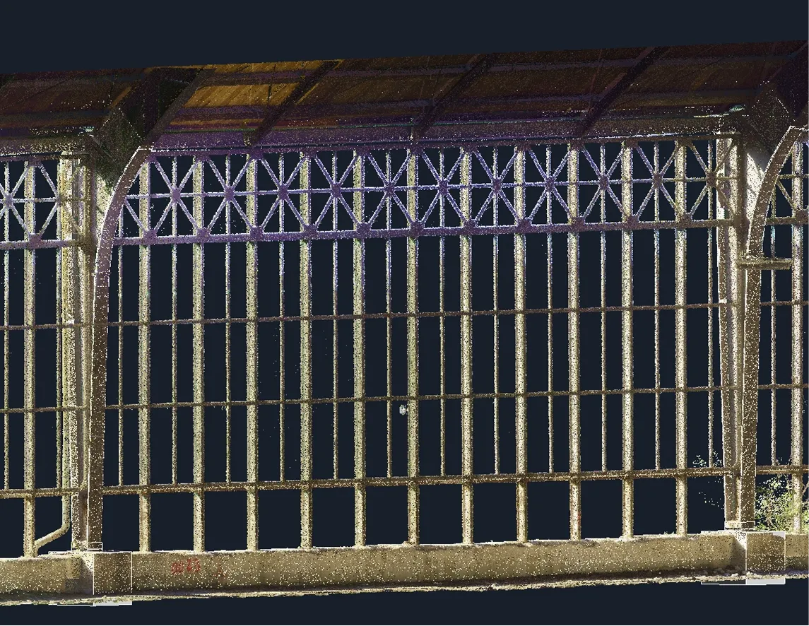
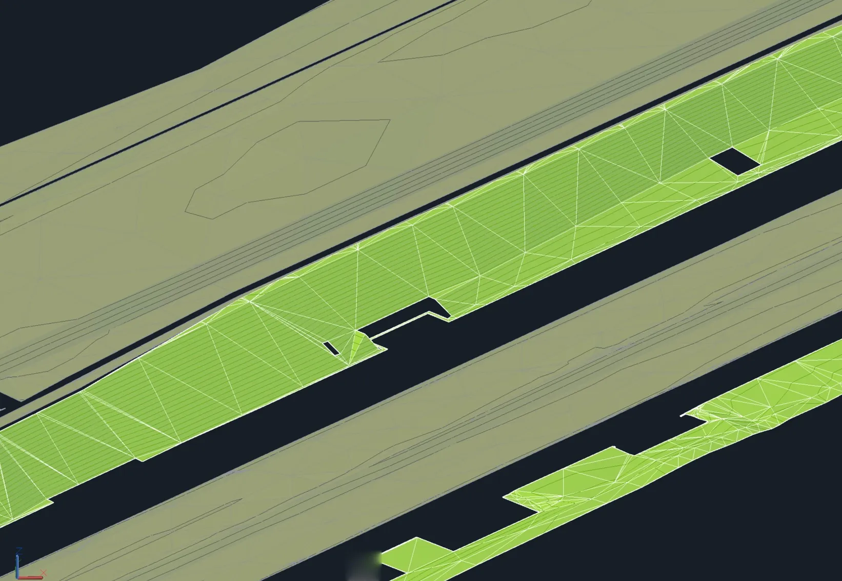
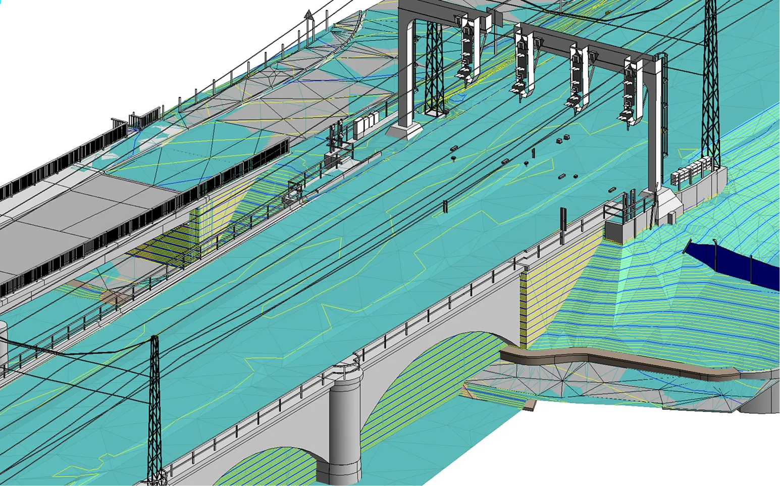
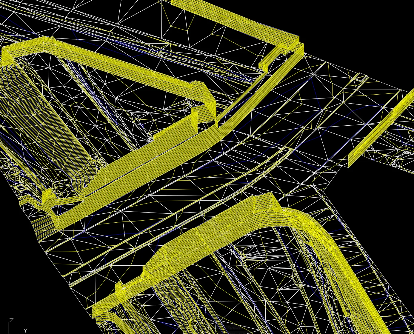
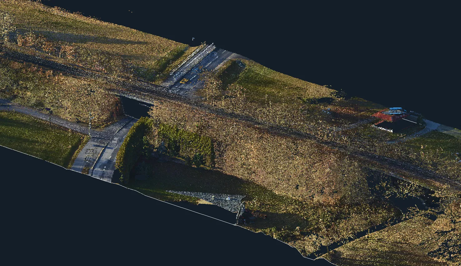
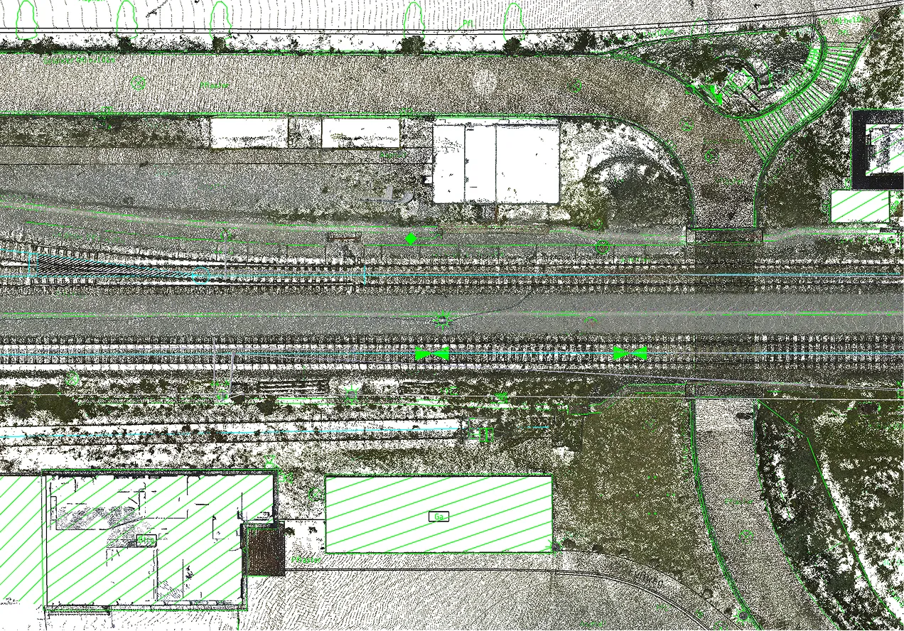
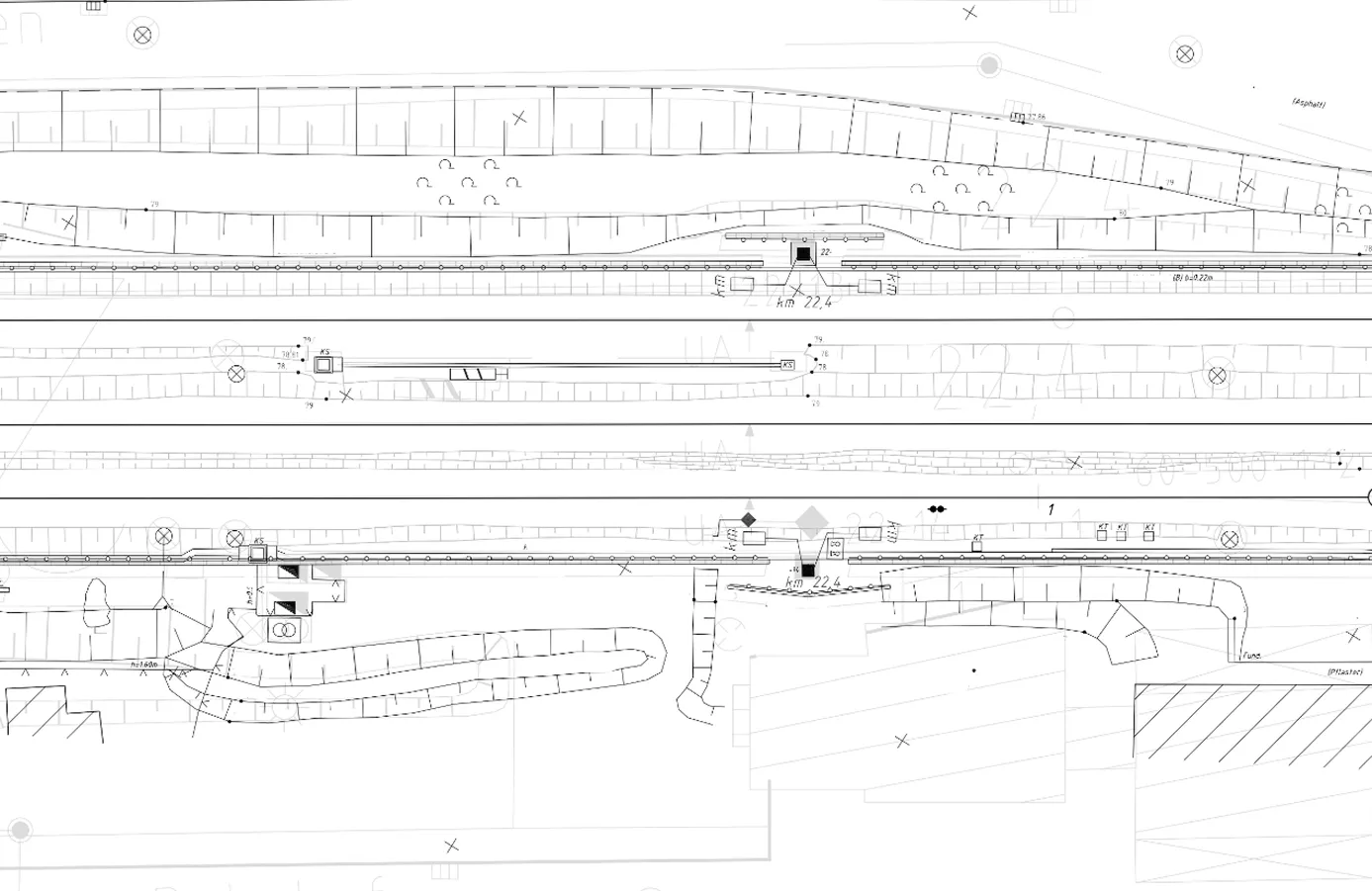
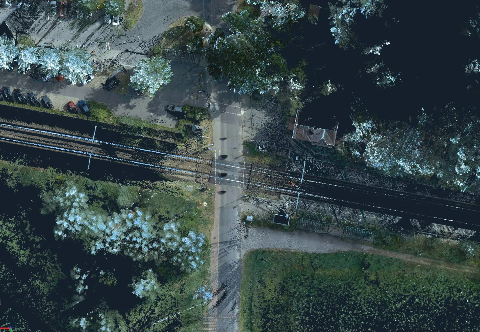
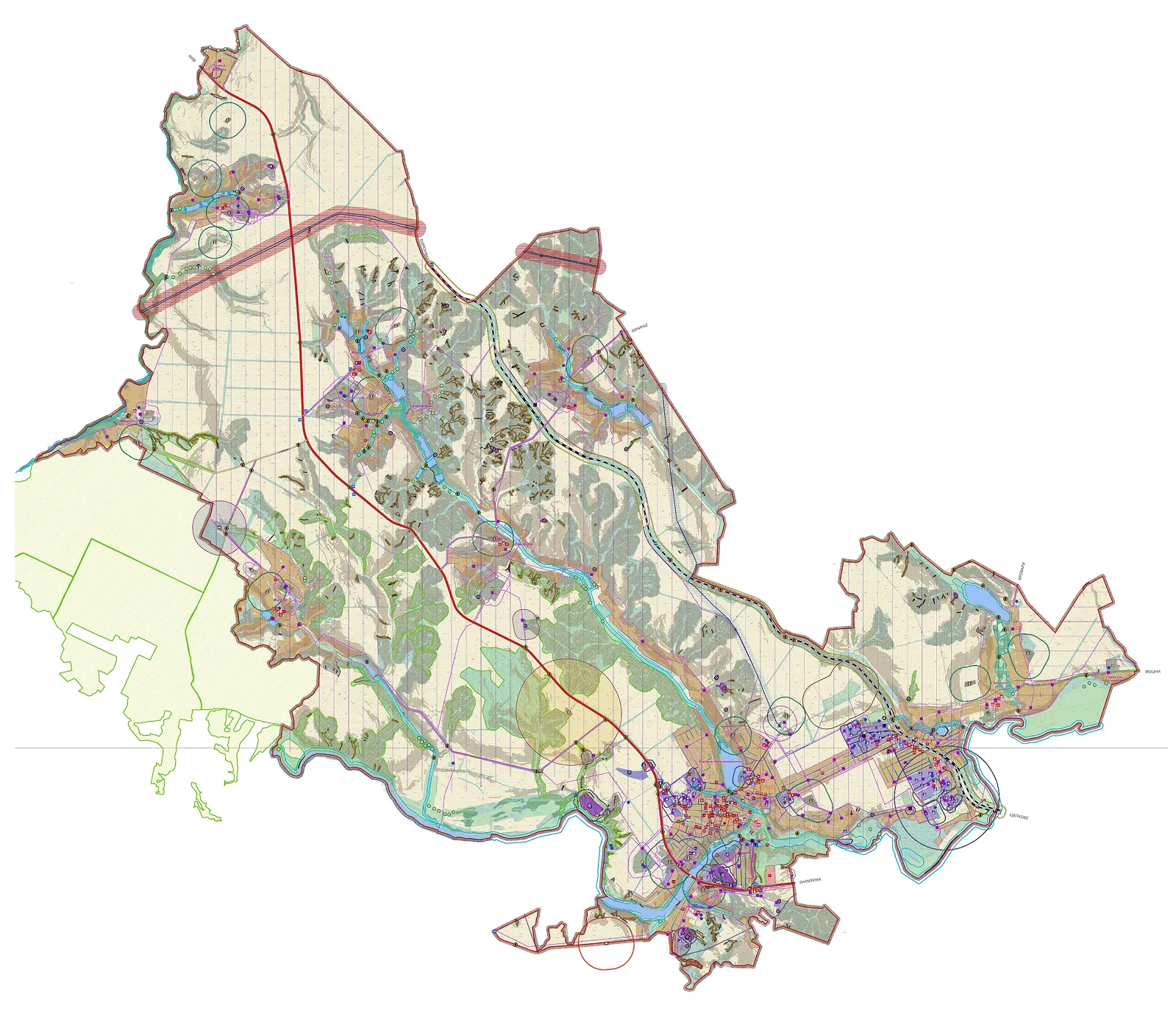
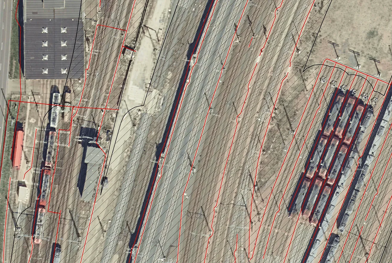
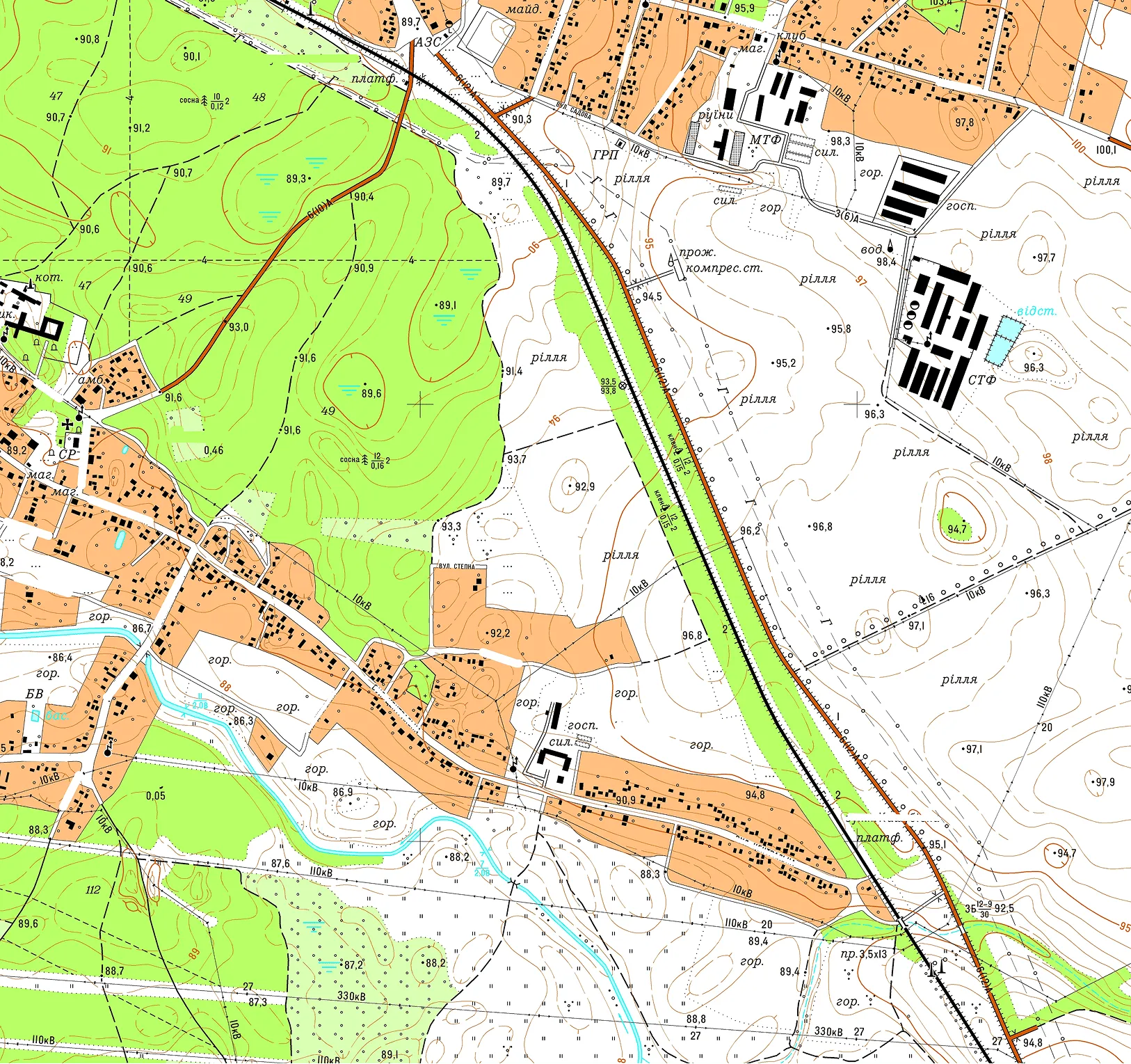
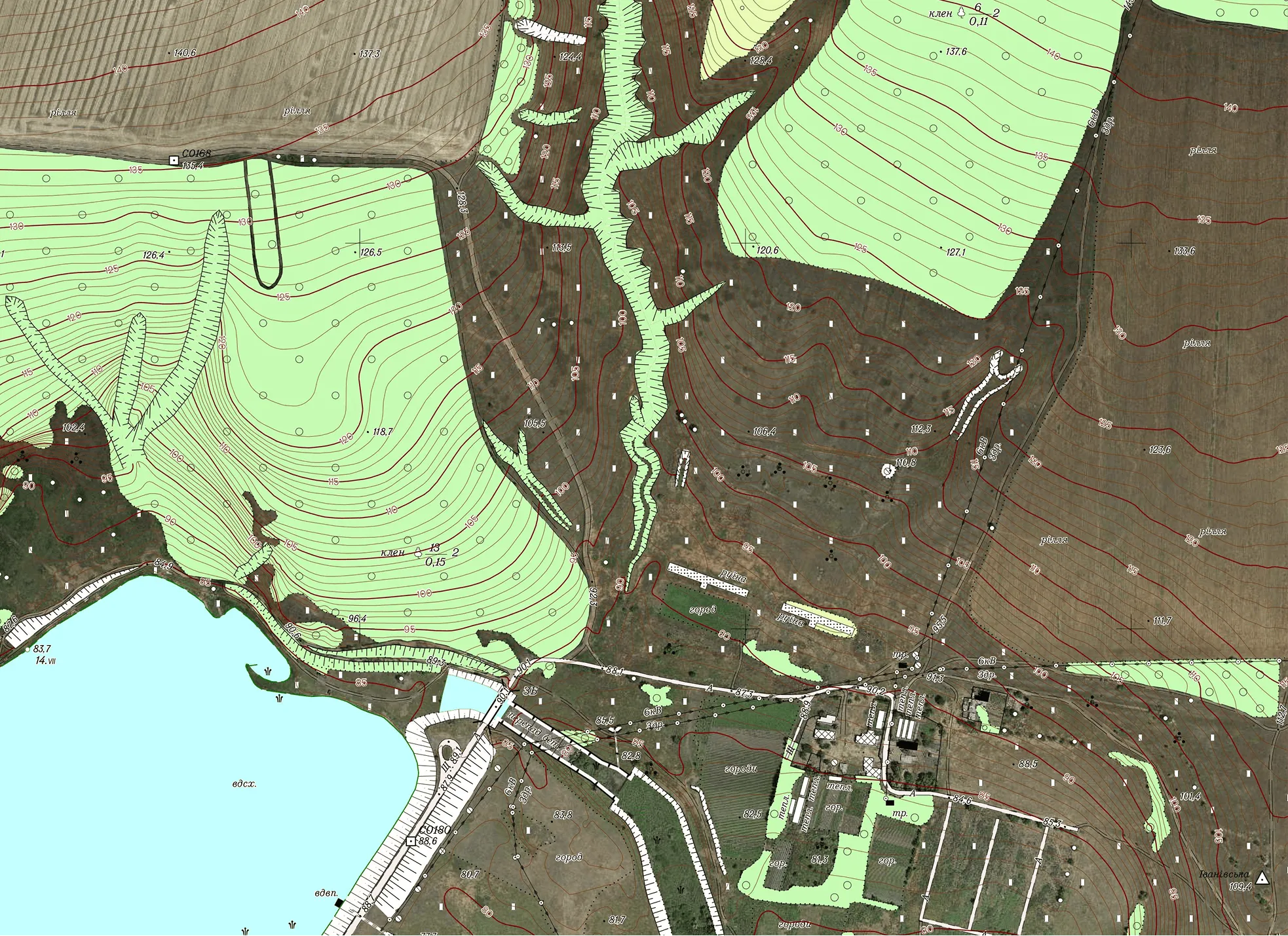
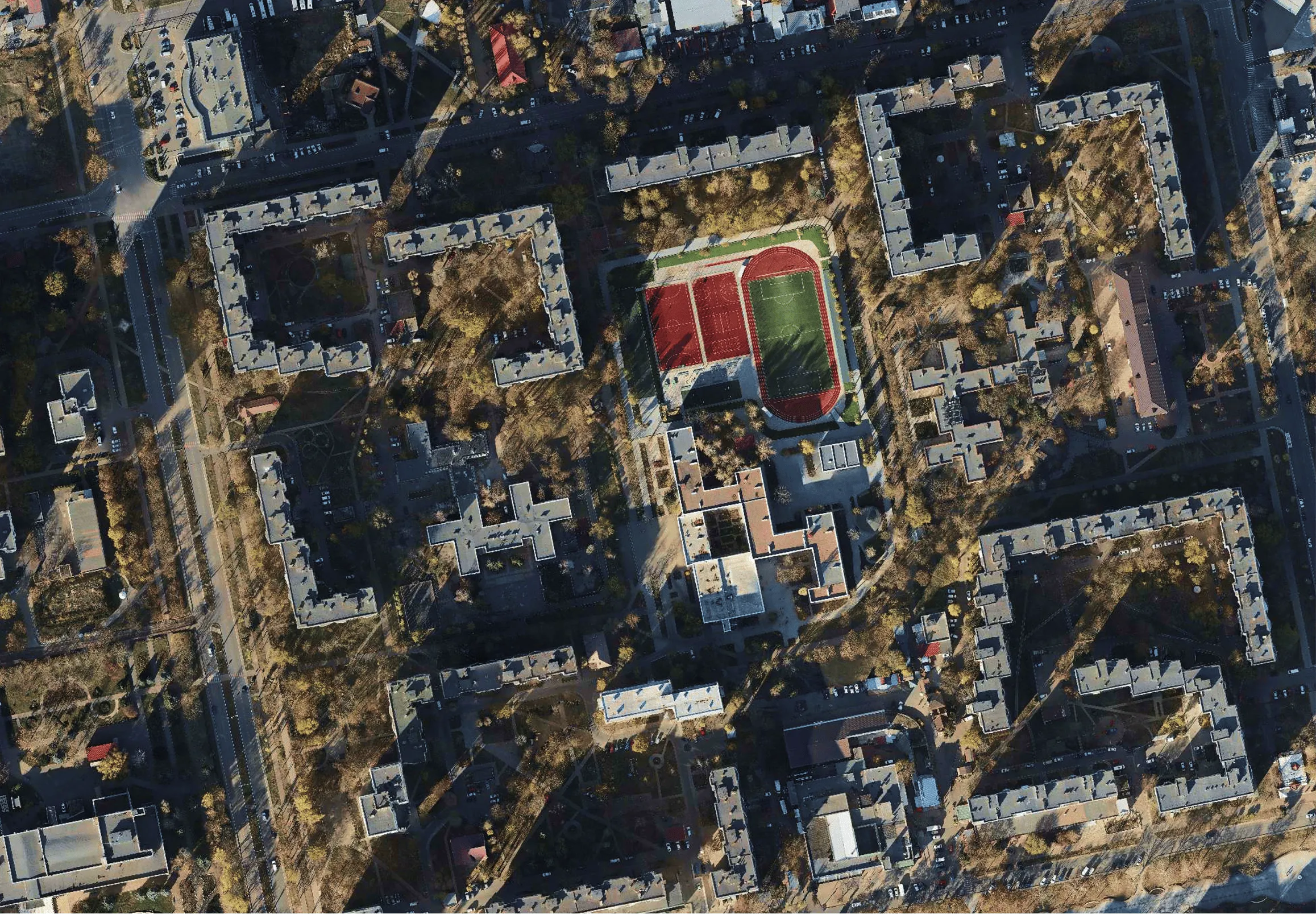
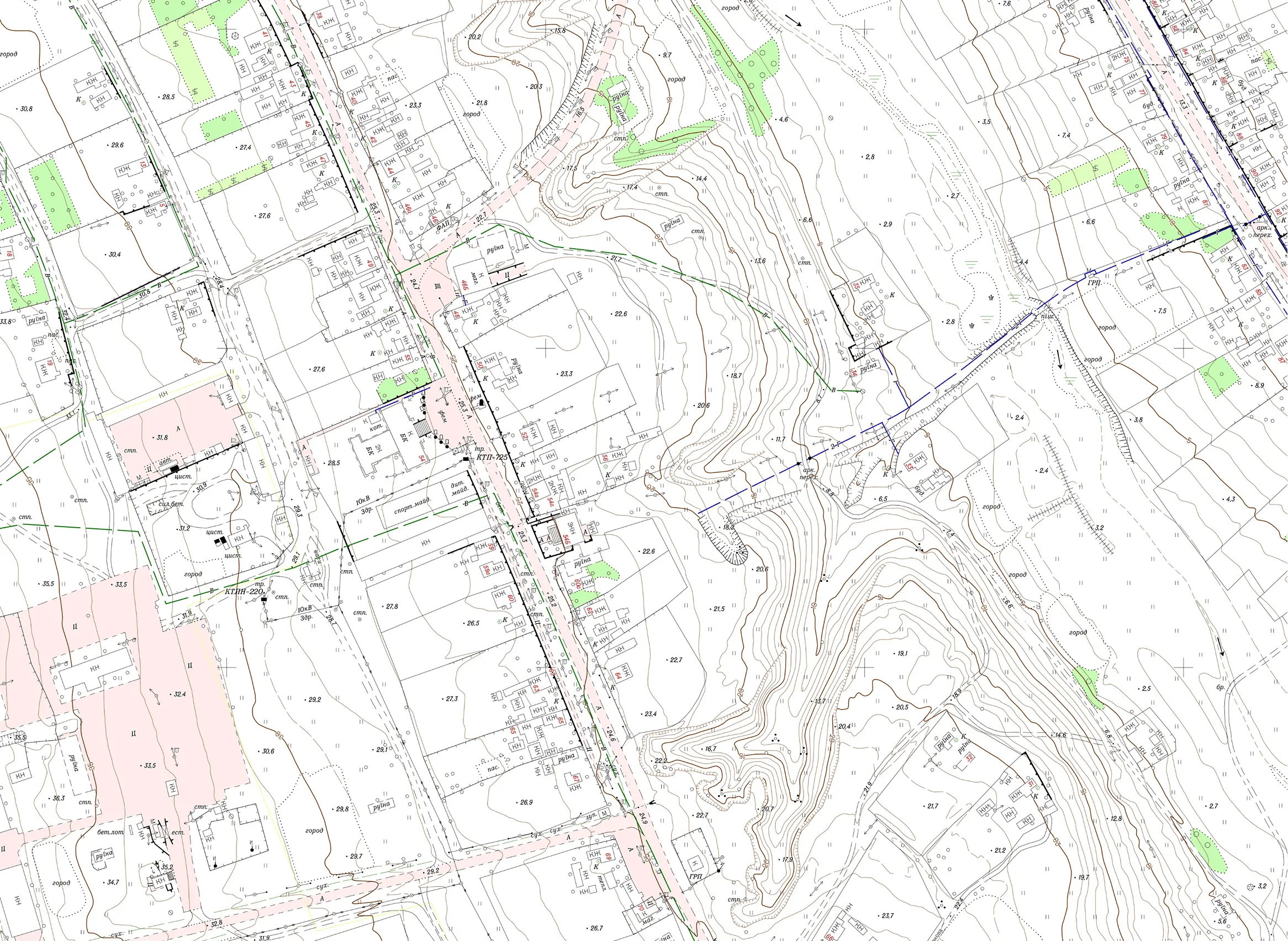
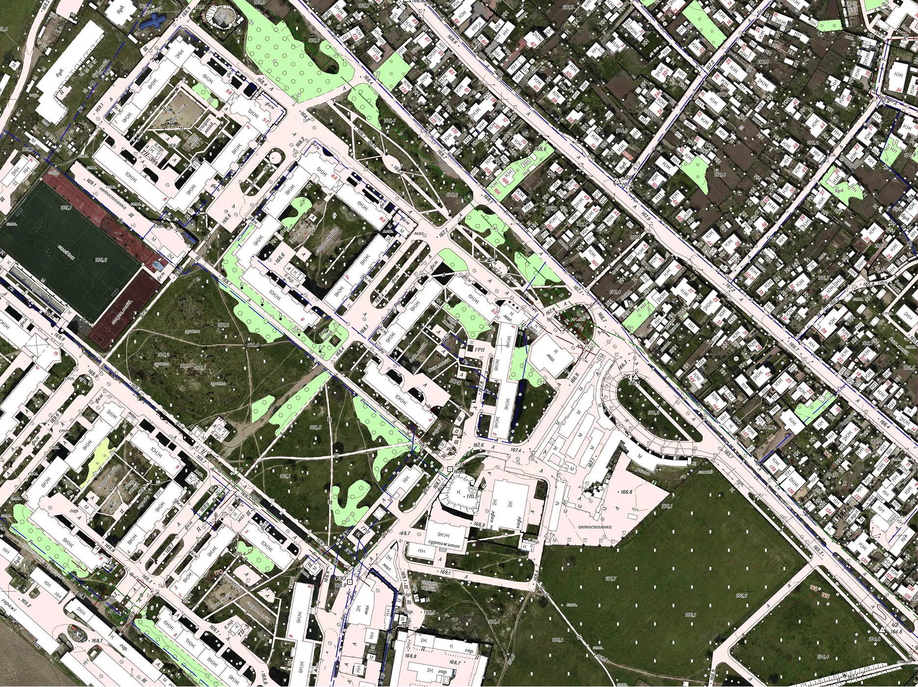
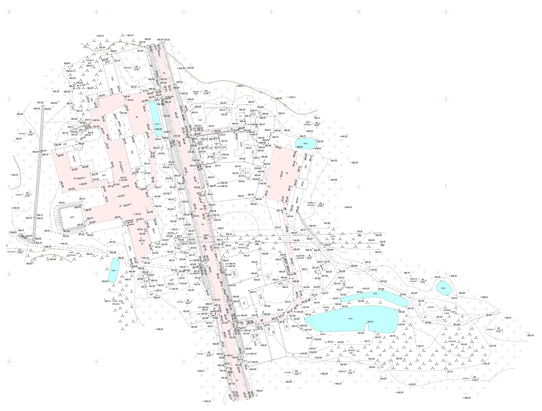
Digital Cartographic Base at a Scale of 1:2,000 for Settlements in Kyiv Oblast

The Archizem team produced a cartographic base at a scale of 1:2,000 in accordance with the “Basic Provisions for Creating Topographic Plans at Scales 1:5,000, 1:2,000, 1:1,000 and 1:500”, and in compliance with all applicable regulations in the field of geodesy and cartography. The total area covered by topographic and geodetic surveys at the 1:2,000 scale was approximately 1,200 hectares.
SEE DETAILS

Update of a Topographic Plan at a Scale of 1:2,000

Archizem specialists updated a topographic plan at a scale of 1:2,000 using aerial survey materials and field inspection results, including topographic surveying with electronic total stations and GNSS receivers. The approximate updated area covered 7,060 hectares.
SEE DETAILS

Topographic Plans at a Scale of 1:1,000 for Land Plots in Volyn Oblast

Commissioned by DAI Global, LLC (DAI) under the USAID Governance and Local Accountability (HOVERLA) Activity, Archizem carried out topographic and geodetic surveying and produced nine topographic plans at a scale of 1:1,000 for designated land plots within a territorial community in Volyn Oblast.
SEE DETAILS

Topographic Base at a Scale of 1:500 for a Land Plot in Chernihiv Oblast

The Archizem team produced a digital topographic base at a scale of 1:500 for a land plot in Chernihiv Oblast. The work was carried out to provide reliable geospatial data for the preparation of design documentation for construction and related engineering purposes.
SEE DETAILS

Digital Topographic Base at a Scale of 1:500 for a Land Plot in Odesa Oblast

The Archizem team produced a digital topographic base at a scale of 1:500 for a land plot in Odesa Oblast to deliver accurate source data for engineering design documentation.
SEE DETAILS

Point Cloud Registration for Tramway Tracks

The Archizem engineering team performed the registration of point clouds captured with the Trimble MX9 mobile mapping system during a survey of tramway infrastructure. As data acquisition was performed in motion, geodetic control points were utilized to refine the scanner trajectory and ensure precise georeferencing, achieving a final registration accuracy of 1–2 cm.
SEE DETAILS

Point Cloud Registration for Railway Infrastructure

Archizem specialists completed the registration of point clouds captured with the Trimble MX9 mobile mapping system during a survey of rail network infrastructure. Since data was collected in motion, the absolute accuracy was enhanced by refining the trajectory using survey targets installed on the ground and on structures. The achieved registration accuracy was up to 3 cm.
SEE DETAILS

Point Cloud Classification for Urban Infrastructure

As part of data preparation for a tramway corridor project, Archizem executed point cloud classification based on datasets captured with the Trimble MX9 mobile scanning system. During processing, the main object classes within the urban environment were identified, including buildings, dynamic objects, road surfaces, ground, vegetation, noise, and other urban features.
SEE DETAILS

High-Accuracy BIM Model of a Railway Station

As part of a comprehensive railway asset inventory project, the Archizem Group developed a detailed as-built BIM model of a railway station. The model provides an exact digital representation of the existing infrastructure, serving as a precise foundation for design, technical analysis, and reconstruction planning.
SEE DETAILS

BIM Model for Railway Station Inventory and Planning

Archizem specialists developed a BIM model of a railway station to document its as-built condition for inventory purposes and to support future infrastructure development planning. This model offers an efficient baseline for technical assessment and the planning of potential modernization and operational improvements.
SEE DETAILS

BIM Model of a Railway Section Featuring a Bridge and an Underpass

Archizem specialists created a BIM model of a railway section that includes a bridge and an underpass. The model accurately captures the current state of these structures, forming a reliable digital basis for subsequent design work and rehabilitation planning.
SEE DETAILS

BIM Model for Noise Barrier Planning Along a Railway Line

Archizem specialists developed a BIM model to facilitate the planning of noise barriers along an 8 km railway section. The model represents the existing infrastructure conditions, providing a solid foundation for subsequent design and engineering decisions.
SEE DETAILS

BIM Model of Structural Columns for a Station Roof

Archizem's team developed a precise BIM model of 12 structural columns and their foundations supporting a station roof. The project focused exclusively on these load-bearing elements to support detailed engineering analysis and further design development.
SEE DETAILS

BIM Modelling of Engineering Structures Along a Railway Section

Archizem’s engineering team delivered detailed BIM models for key engineering assets along a railway corridor, including bridges, culverts, level crossings, cable ducts, manholes, signalling elements, and other infrastructure components.
SEE DETAILS

Digital Terrain Model of a Railway Station Area Aligned with a BIM Model

Archizem's engineering team developed a precise Digital Terrain Model (DTM) for a 450-meter railway corridor section, covering a 50-meter wide area that included both infrastructure and adjacent land.
SEE DETAILS

Digital Terrain Model for Noise Barrier Planning

Archizem's engineering team produced a Digital Terrain Model (DTM) for an 8 km railway corridor with a 50-meter buffer, covering areas both inside and outside settlements. This model established a consistent geospatial baseline for the design of noise mitigation measures.
SEE DETAILS

Digital Terrain Model Along a Railway Line

Archizem's engineering team created a Digital Terrain Model (DTM) for a 21 km railway section, with a 40–60 meter buffer covering densely built-up and forested areas.
SEE DETAILS

Digital Terrain Model Along a Railway Corridor

Archizem specialists generated a Digital Terrain Model (DTM) for a 6 km railway corridor within a 100-meter buffer, encompassing built-up and open terrain.
SEE DETAILS

Cross-Section Profiles of a Railway Track Based on Point Clouds

Archizem’s engineering team produced precise cross-section profiles for a railway track section using point cloud data. To achieve high accuracy, mobile laser scanning data from the Trimble MX9 system was integrated with total station survey results, creating a highly reliable and detailed source dataset.
SEE DETAILS

Architectural Drawings of a School Building

Archizem specialists prepared a complete set of 2D CAD drawings (elevations and sections) for a school building in Germany, based on a laser scanning point cloud. The project aimed to accurately document the asset and create a reliable baseline for future refurbishment and modernization projects.
SEE DETAILS

Architectural Drawings of a Historic Cathedral in CAD Format

Archizem’s engineering team developed a comprehensive set of 2D CAD drawings for a historic cathedral in Spain, based on a laser scanning point cloud. This project contributes to architectural heritage preservation and establishes a precise graphic baseline for restoration and research activities.
SEE DETAILS

Architectural Drawings for a Residential Building Based on a Point Cloud (CAFM)

Archizem specialists prepared a full set of architectural drawings for a residential building in France, using a laser scanning point cloud. The client, a French real-estate and facilities management company, required accurate building geometry for integration into its Computer-Aided Facility Management (CAFM) system to support ongoing operations and future refurbishment planning.
SEE DETAILS

Architectural Drawings for an Office Building Based on a Point Cloud (CAFM)

The Archizem team developed a complete set of architectural drawings for an office building, based on a laser scanning point cloud, for a German client specializing in Computer-Aided Facility Management (CAFM). The primary objective was to create an accurate as-built record to support facility management, refurbishment planning, and technical maintenance.
SEE DETAILS

Topographic Site Plan (1:500) for Design Documentation Update

Archizem prepared a detailed topographic site plan at a scale of 1:500 for a 3.5-hectare electrical substation site to support the update of its design documentation. The plan meticulously maps all key engineering infrastructure elements and adjacent areas within the project boundaries.
SEE DETAILS

3D As-Built Model of a Railway Bridge

Archizem developed a precise 3D as-built model of a railway bridge to facilitate a detailed assessment of its current technical condition and geometry.
SEE DETAILS

Topographic Plan (1:250) for Engineering Design Update

To facilitate the update of design documentation for a linear infrastructure project, Archizem produced a topographic plan at a scale of 1:250 for a corridor approximately 1 km long and up to 70 m wide. The plan details all engineering infrastructure elements and adjacent features within the specified limits.
SEE DETAILS

Topographic Plan (1:200) for Railway Infrastructure Reconstruction

Archizem completed the office processing of topographic and geodetic data and produced a detailed topographic plan at a scale of 1:200 for a railway corridor approximately 4.75 km long and up to 60 m wide. The plan captures all railway and engineering infrastructure elements, as well as adjacent areas, within the project scope.
SEE DETAILS

Topographic Plans (1:200) for 95 Railway Level Crossings

Archizem completed the topographic and geodetic data processing and produced 95 individual topographic plans at a scale of 1:200 for railway level crossings. Each plan details the transport and engineering infrastructure, along with surrounding features, within the defined project area for every location.
SEE DETAILS

Free data audit and calculation — within 24 hours.

Submit your request

Our specialists will conduct a free analysis of your source data and provide a detailed proposal with cost and timelines within one business day.
Grazie! Your submission has been received!
We have received your request and will contact you shortly
Oops! Something went wrong. Please try again.
0
%