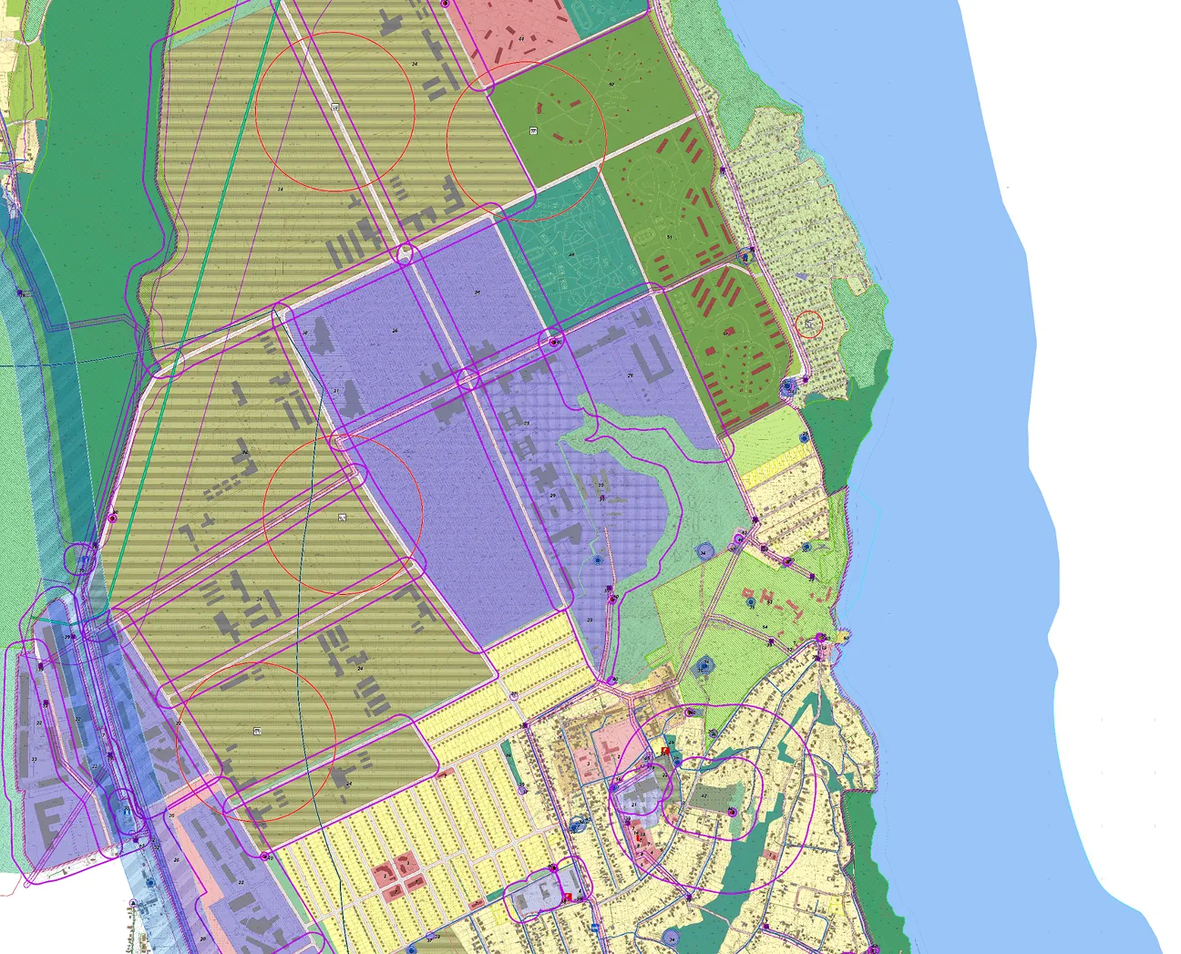
The Archizem team developed a comprehensive spatial development plan for a city territorial community in southern Ukraine as a practical framework for balanced territorial growth. The plan integrates a major industrial and port cluster with residential development, recreational areas, and agricultural land—creating a coherent vision for land use and infrastructure development.
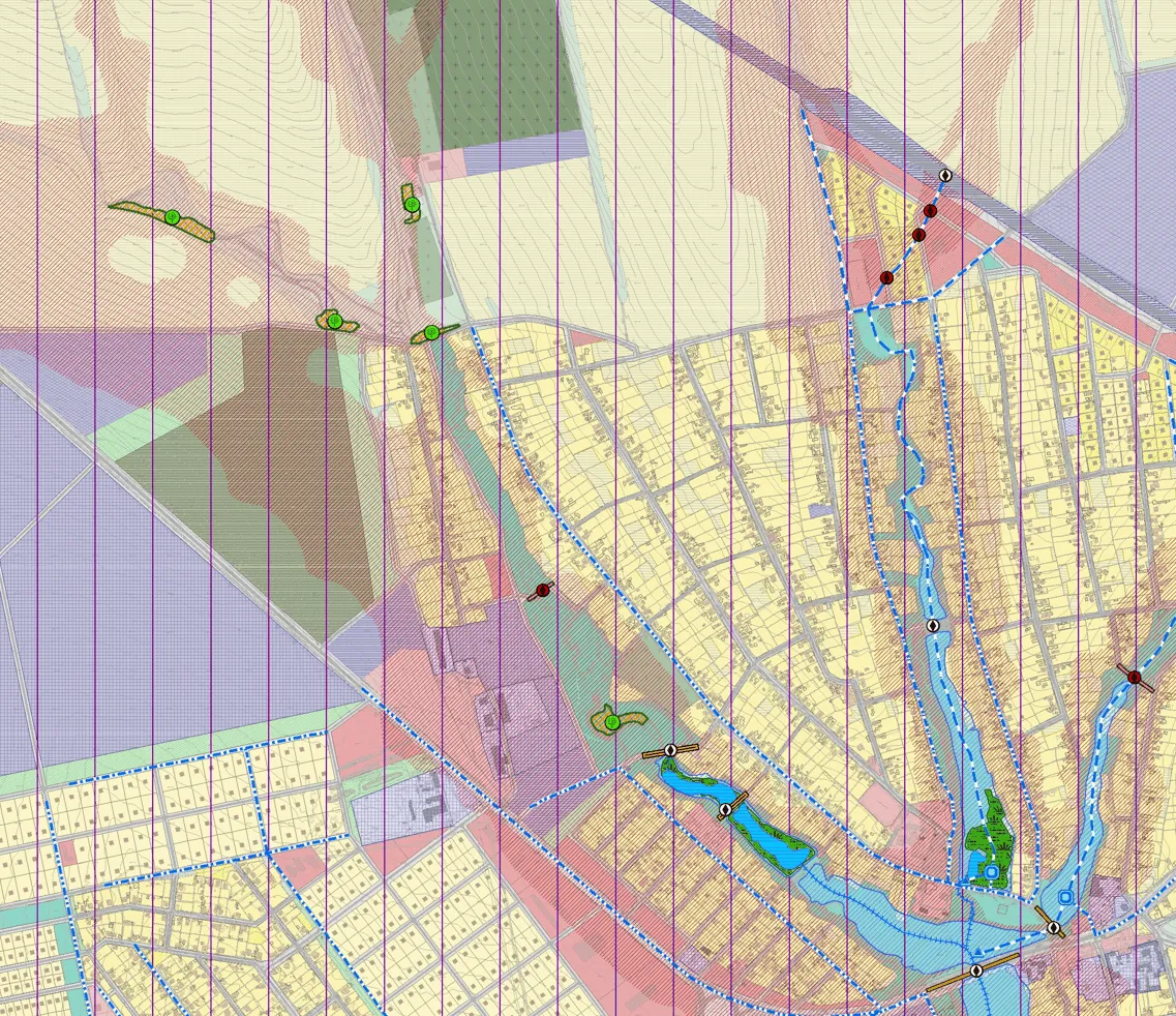
The plan defines the community’s functional and planning structure, with the city serving as the administrative, economic, and logistics core. It provides for the expansion of residential neighborhoods, strengthening of social infrastructure (education, healthcare, culture), and the creation of modern public spaces. For suburban villages, the plan outlines modernization of development patterns, utility networks, and transport links with the city.
The industrial sector is oriented toward further development of port and logistics facilities. In transport planning, priorities include upgrading the street and road network, constructing new bypass routes, and improving connectivity to international transport corridors. In agriculture, the plan preserves production lands and supports the development of agro-processing.
A dedicated focus is placed on developing recreational areas, including the formation of tourism clusters and new leisure, sports, and wellness infrastructure. The planning framework also accounts for land-use constraints, including sanitary protection zones, protected corridors, nature conservation areas, and cultural heritage zones.
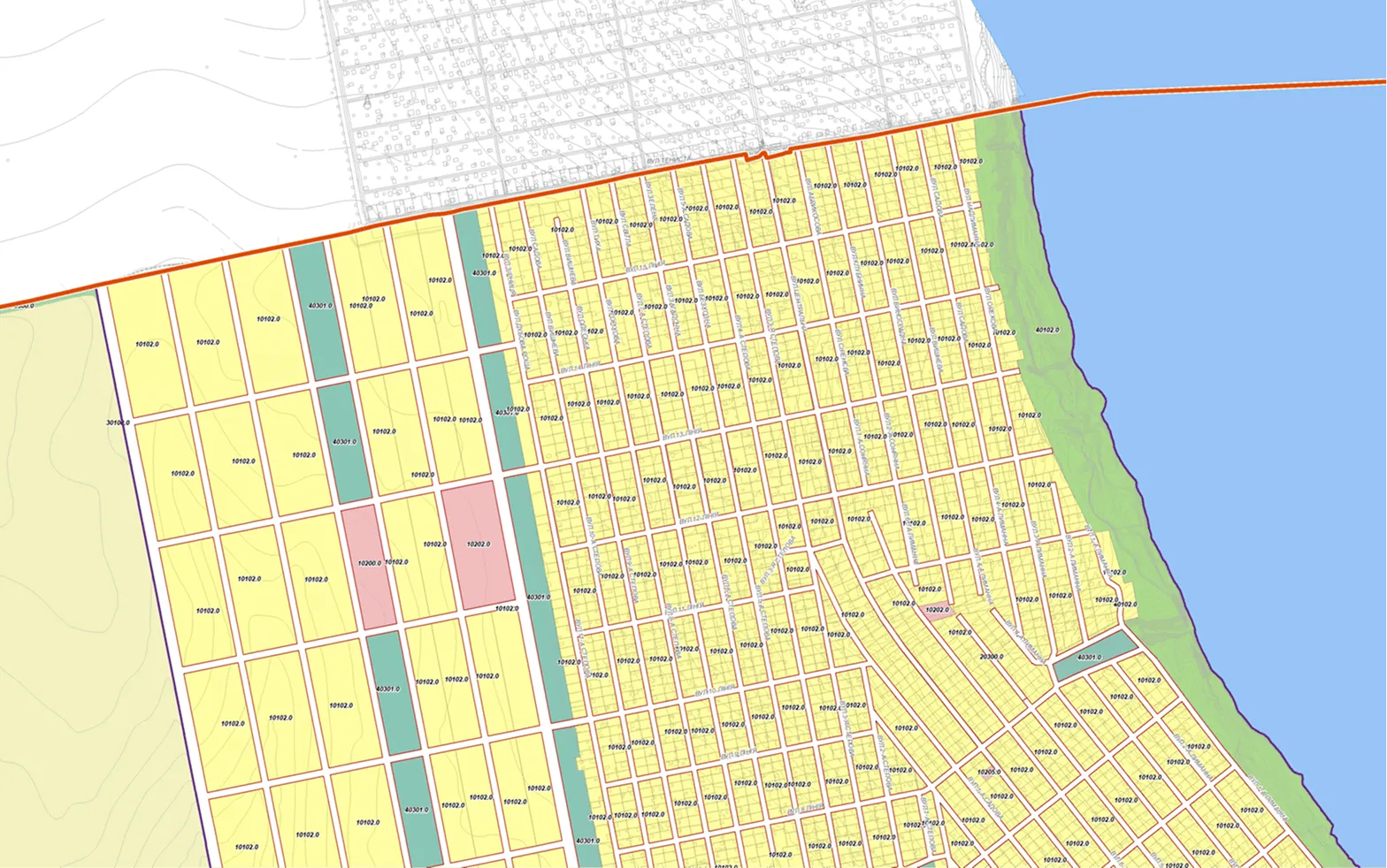
As part of the urban planning documentation package, Archizem ensured that all graphical and textual materials comply with urban planning cadastre requirements: data is structured within a standardized geodatabase model aligned with legal requirements and INSPIRE principles. The datasets are prepared in formats suitable for use in a unified geoportal and territorial management systems. Referencing the materials to the national coordinate system USC-2000 and using specialized GIS software ensures accurate representation of features and seamless integration into cadastre resources, including the urban planning cadastre.
As a result, the community receives a robust digital baseline for spatial governance—from land-use control to investment planning—ensuring transparency and accessibility for authorities, businesses, and the public.