Comprehensive Plan for the Spatial Development of the Territory
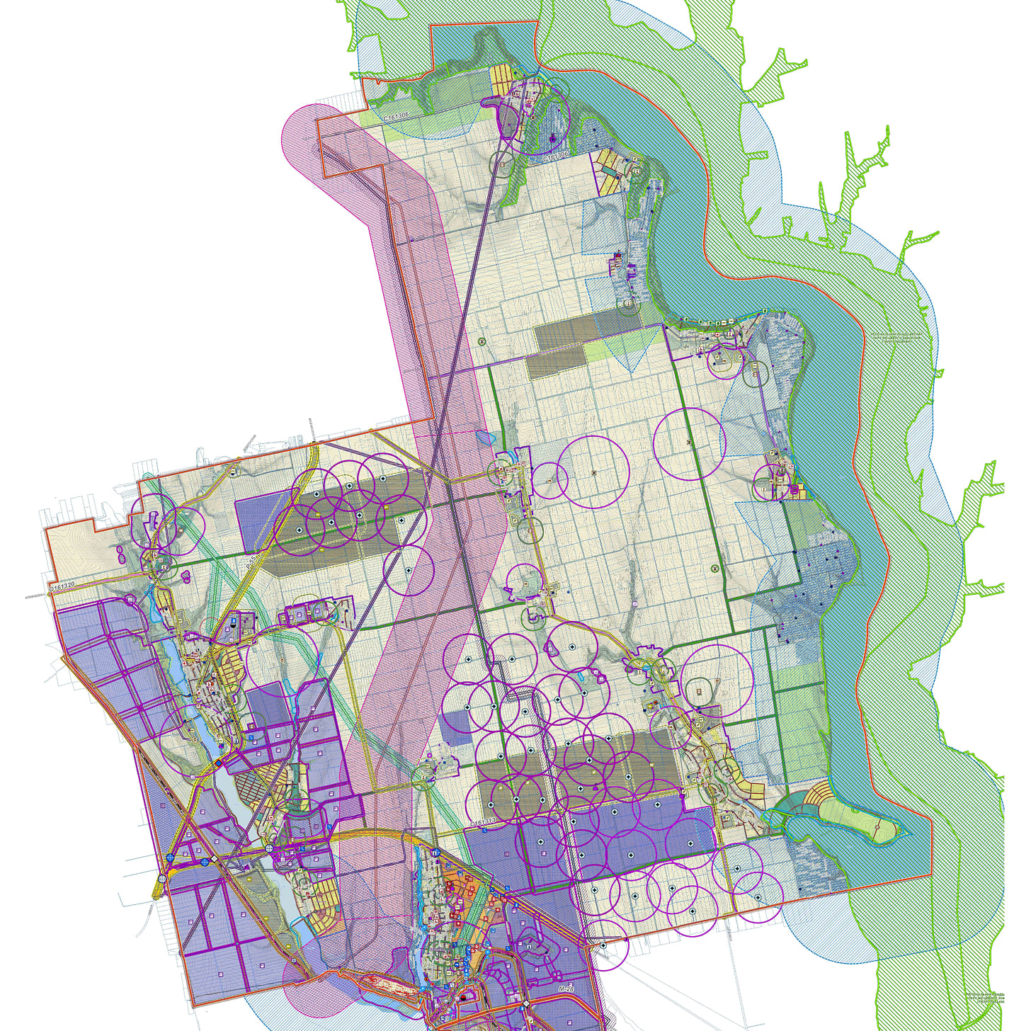
The Comprehensive Plan for the Spatial Development of the Territorial Community (CSDP) is simultaneously a local-level urban planning document and land management documentation, developed for the entire territory of the community.
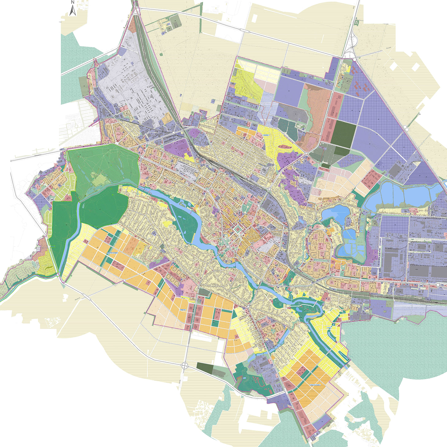
It defines the development strategy for the entire community as a unified system, covering the planning structure, functional purpose of territories, and directions for developing all key areas: from housing, infrastructure, and the industrial complex to environmental protection and cultural heritage.
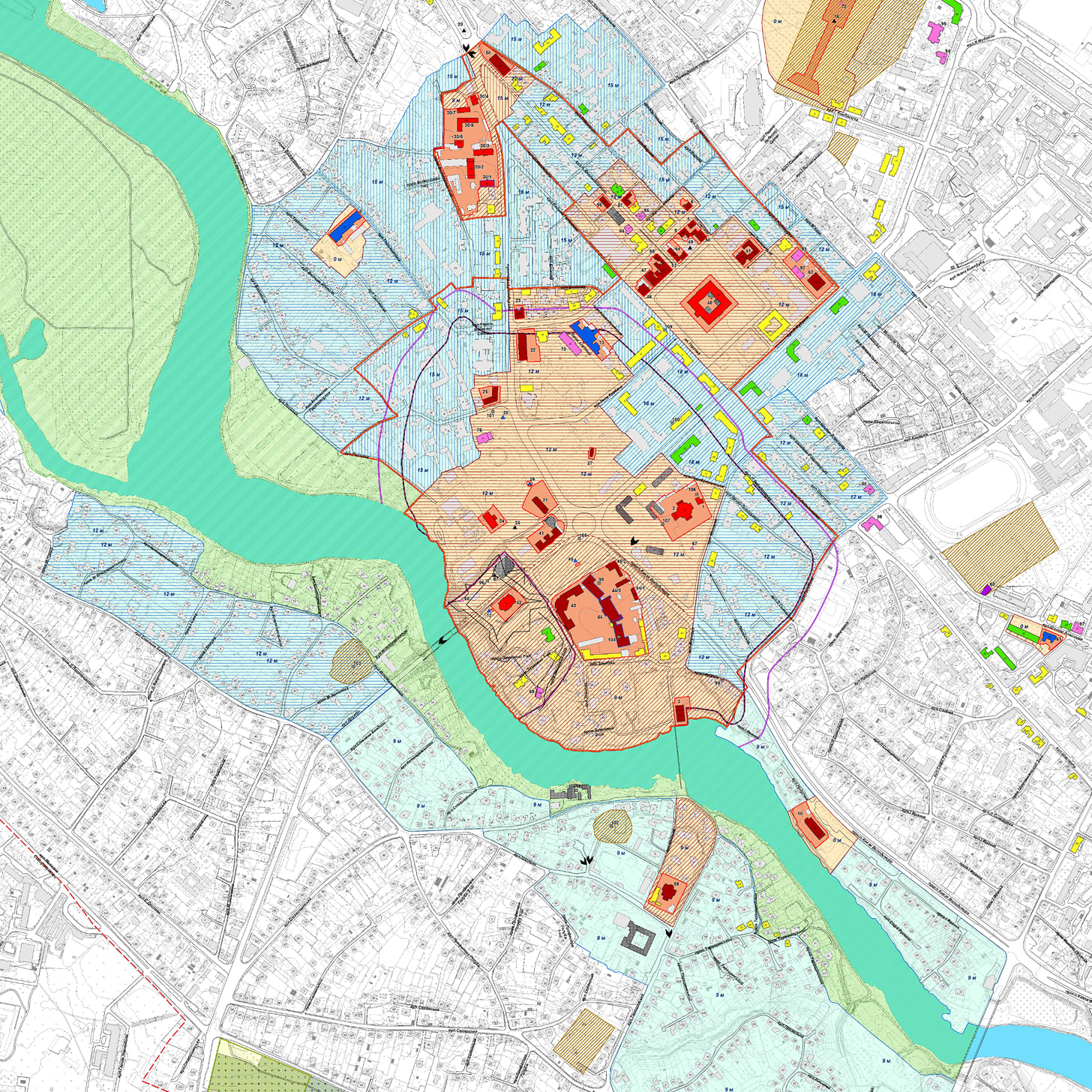
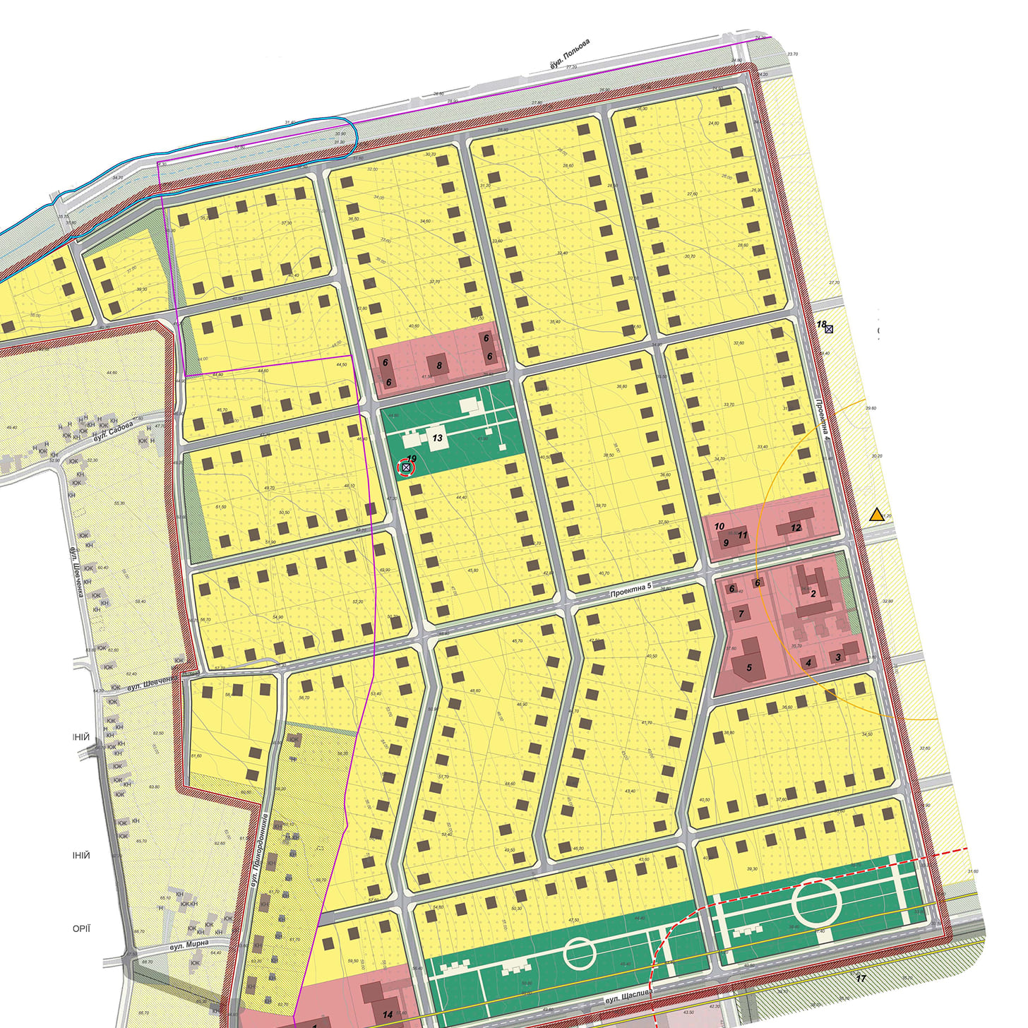
The CSDP combines urban planning and land management for the entire community in one document, resolves conflicts and eliminates chaos by aligning infrastructure, environmental, and historical restrictions with development. It standardizes land use restrictions, establishes the sequence for implementing decisions and the phasing of territory development, and provides a digital foundation for integration with state cadastres and management decision-making.