Effective management and modernization of complex infrastructure require a precise and current digital representation. This was the core objective set for Archizem by the client: to create an accurate, up-to-date digital model of key railway network objects.
The goal was to develop a comprehensive geospatial database covering all critical infrastructure elements for subsequent use in analytical systems, capital repair planning, and management decision-making.
The Archizem team applied a hybrid methodology, combining multiple data sources and tools:
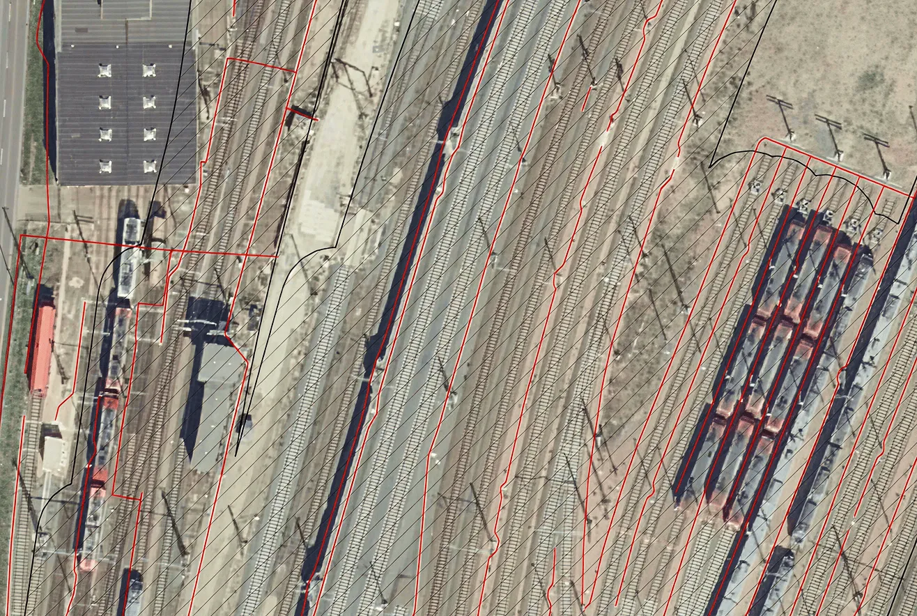
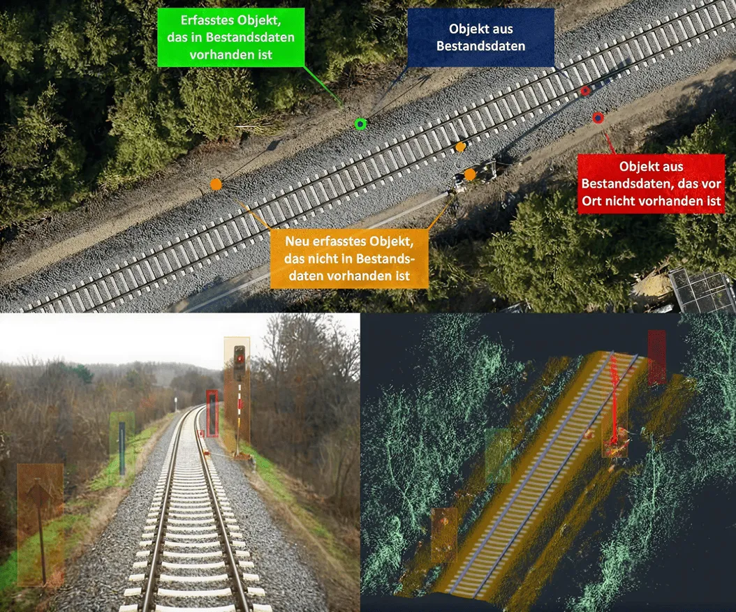
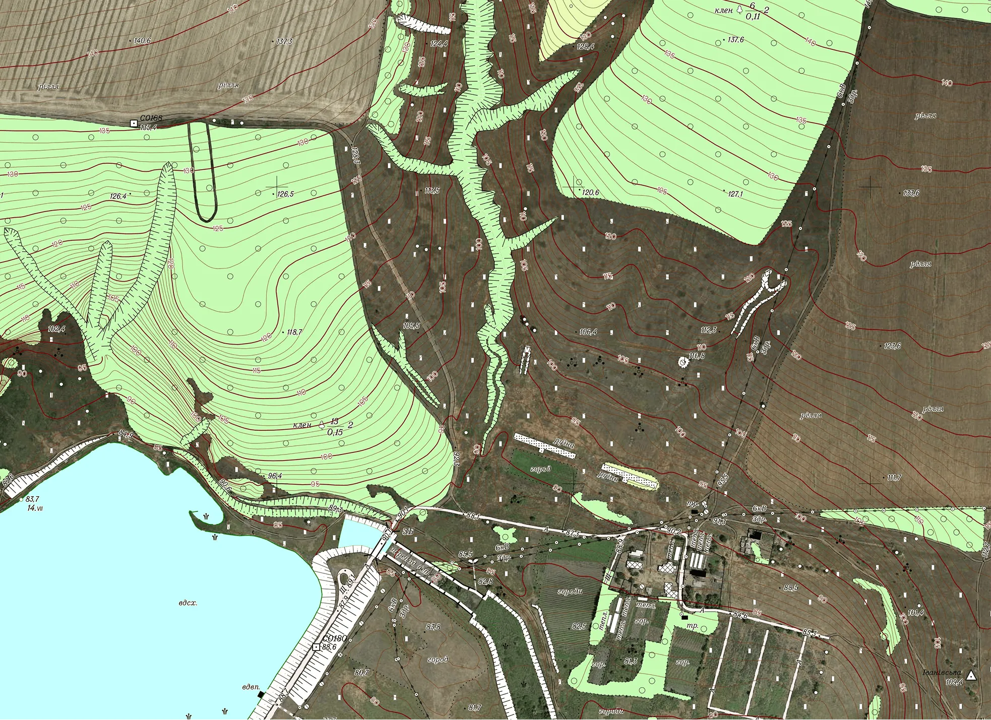
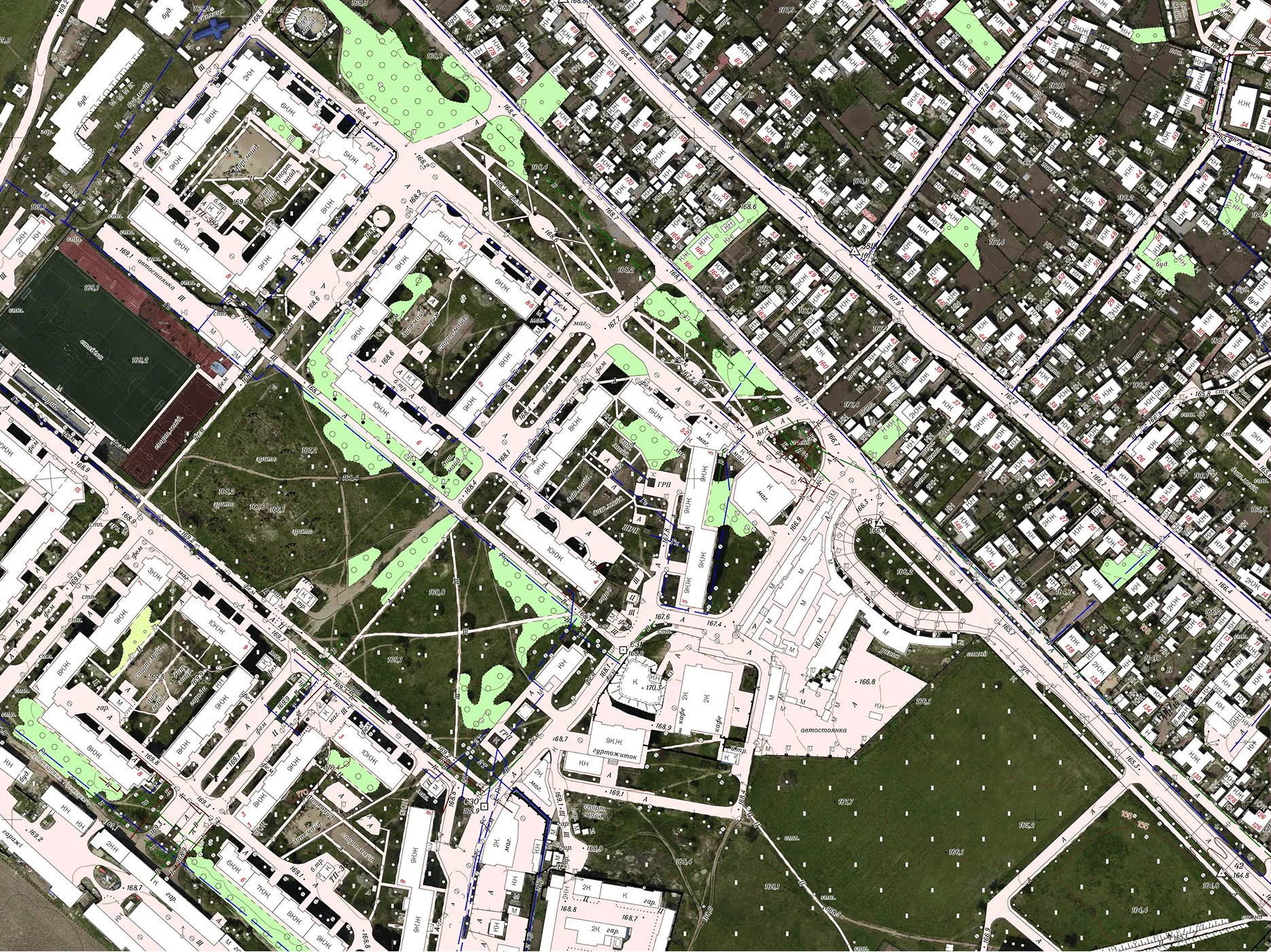
- Data foundation: Detailed laser scanning point clouds, high-precision orthophoto maps, panoramic images, and archival maps served as source data.
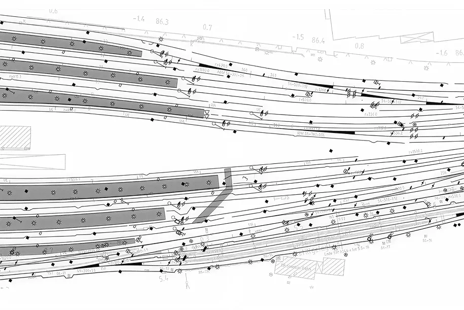
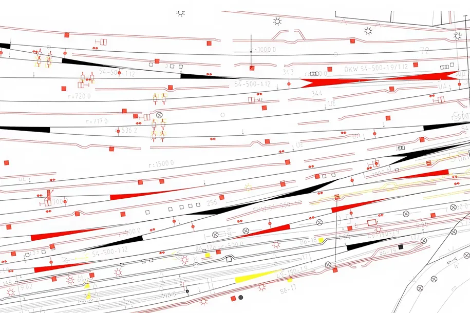
- 3D modeling for complex objects: Structures such as bridges, tunnels, viaducts, noise barriers, and complex junctions were modeled in professional CAD systems to ensure maximum geometric accuracy.
- Efficient 2D digitization in GIS: Linear and areal elements (tracks, overhead contact lines, boundaries) were digitized directly within the GIS environment. This approach enabled the rapid creation of clean, structured thematic layers with correct attribute data.
The project involved a full inventory of all key infrastructure, including:
- track and turnouts;
- overhead contact line system (catenary, supports);
- engineering structures (bridges, viaducts, tunnels, culverts);
- ancillary structures (noise protection screens);
- safety and communication systems (signalling, interlocking, block systems, telecommunication lines);
- electrical installations.
As a result, the client received a modern, populated unified geodatabase. It serves as a reliable foundation for:
- detailed technical analysis of each asset's condition;
- strategic planning of capital repairs and preventive maintenance;
- cost optimization through precise resource control;
- informed management decisions based on current spatial data.
The delivered digital model transforms railway infrastructure management into a predictable, efficient, and future-ready process.