3D Modeling (Scan-to-BIM)

The Scan-to-BIM technology ensures a flawless transfer of a real-world object into the digital space, which is critical for reconstruction, design of new structural nodes, precise inventory, and technical maintenance planning.
We offer the full cycle of creating such information models: from the expert preparation of the source point clouds to building geometrically accurate and data-rich 3D models in Revit or other CAD environments.
We create models of any complexity: from individual elements to infrastructure complexes. They provide an accurate foundation for design decisions, calculations, and management.
Areas
We create models of any complexity: from individual elements to infrastructure complexes. They provide an accurate foundation for design decisions, calculations, and management.

Case Studies

Exceptional results in complex projects

BIM Modelling of Engineering Structures Along a Railway Section

Archizem’s engineering team delivered detailed BIM models for key engineering assets along a railway corridor, including bridges, culverts, level crossings, cable ducts, manholes, signalling elements, and other infrastructure components.
SEE DETAILS

BIM Model of Structural Columns for a Station Roof

Archizem's team developed a precise BIM model of 12 structural columns and their foundations supporting a station roof. The project focused exclusively on these load-bearing elements to support detailed engineering analysis and further design development.
SEE DETAILS

Services

01

BIM Model Creation (Scan-to-BIM) in Revit

For complex projects requiring an intelligent, object-oriented model, we perform the full Scan-to-BIM cycle. Based on point clouds or aerial photography data, we create geometrically accurate models with Levels of Development (LOD) ranging from LOD 100 to LOD 400. These models include not only the basic geometry but also extended attribute information: structural layers, materials, technical parameters, and logical connections between elements.

Such an informational digital twin of the object becomes an indispensable tool for reconstruction, detailed engineering analysis, coordinated design, and efficient asset management.

Our many years of experience in executing projects for clients from the EU guarantee strict compliance with local standards (including Deutsche Bahn InfraGO), format requirements, and specified accuracy. We ensure full compatibility of the models with subsequent stages of design or operation.

Execution Stages:

Technical Specification Alignment

Definition with the client of the project goals, required Level of Development (LOD), format requirements, model structure, and scope of work.
01

Analysis of Source Data

Assessment of the quality, density, and correctness of the coordinate system of the received point cloud. Preparation and conversion of data for further modeling.
02

Point Cloud Editing
(if necessary)

Removal of unnecessary zones and artifacts ("noise"), optimization of file size for efficient work in CAD and BIM environments.
03

Modeling

Creation of an informational 3D model based on the point cloud while adhering to the specified LOD. Step-by-step formation of objects and enrichment with attribute information.
04

Quality Control and Compliance Check

Internal model verification: control of geometric correspondence, integrity, detection and elimination of clashes and technical errors.
05

Final Delivery of Results

Export of the model to the agreed format (.rvt, .dwg, etc.), compilation of necessary technical documentation, and delivery of the results to the client.
06

Technical Specification Alignment

Definition with the client of the project goals, required Level of Development (LOD), format requirements, model structure, and scope of work.
01

Analysis of Source Data

Assessment of the quality, density, and correctness of the coordinate system of the received point cloud. Preparation and conversion of data for further modeling.
02

Point Cloud Editing (if necessary)

Removal of unnecessary zones and artifacts ("noise"), optimization of file size for efficient work in CAD and BIM environments.
03

Modeling

Creation of an informational 3D model based on the point cloud while adhering to the specified LOD. Step-by-step formation of objects and enrichment with attribute information.
04

Quality Control and Compliance Check

Internal model verification: control of geometric correspondence, integrity, detection and elimination of clashes and technical errors.
05

Final Delivery of Results

Export of the model to the agreed format (.rvt, .dwg, etc.), compilation of necessary technical documentation, and delivery of the results to the client.
06

Services

02

3D Model Creation in CAD

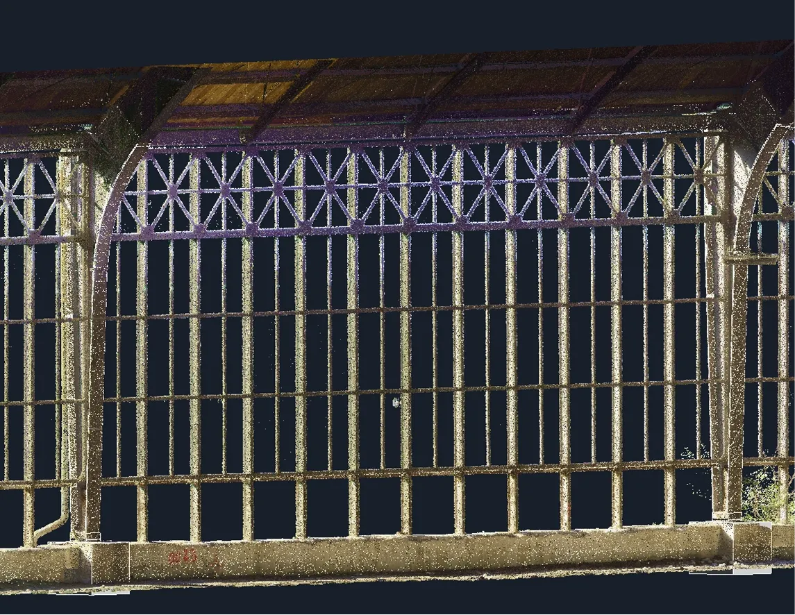
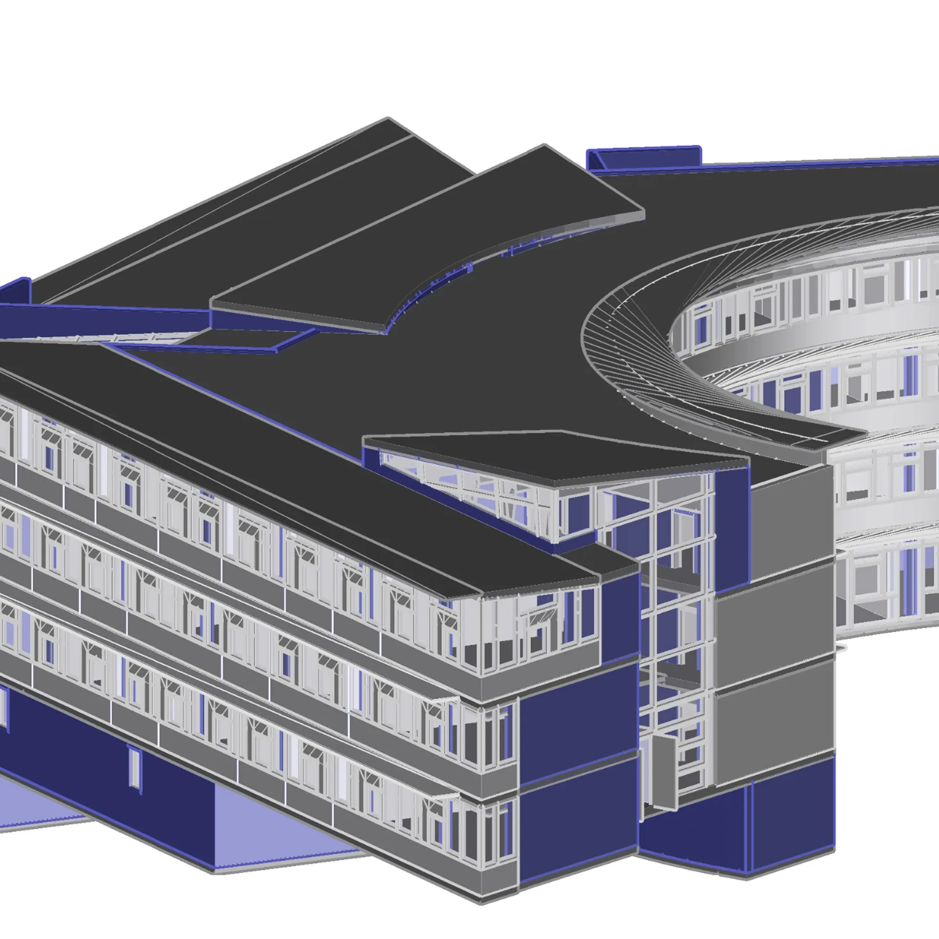
For tasks focused on architectural visualization, precision drawing development, or technical inventory, we offer the creation of detailed 3D models in a CAD environment.

This process allows for the accurate reproduction of buildings, complex facades, and interior spaces in digital format based on scanning. The resulting model in DWG format serves as a universal basis for developing drawings, a complete set of technical documentation, architectural sections and elevations, archiving, or preparation for reconstruction.

The use of CAD ensures high flexibility, enabling the effective combination of 2D and 3D processes, quick implementation of changes, and integration of the model at any stage of architectural or engineering planning.

Execution Stages:

Technical Specification Alignment

Definition with the client of the project goals, required Level of Development (LOD), format requirements, model structure, and scope of work.
01

Analysis of Source Data

Assessment of the quality, density, and correctness of the coordinate system of the received point cloud. Preparation and conversion of data for further modeling.
02

Point Cloud Editing
(if necessary)

Removal of unnecessary zones and artifacts ("noise"), optimization of file size for efficient work in CAD and BIM environments.
03

Modeling

Creation of an informational 3D model based on the point cloud while adhering to the specified LOD. Step-by-step formation of objects and enrichment with attribute information.
04

Quality Control and Compliance Check

Internal model verification: control of geometric correspondence, integrity, detection and elimination of clashes and technical errors.
05

Final Delivery of Results

Export of the model to the agreed format (.rvt, .dwg, etc.), compilation of necessary technical documentation, and delivery of the results to the client.
06

Technical Specification Alignment

Definition with the client of the project goals, required Level of Development (LOD), format requirements, model structure, and scope of work.
01

Analysis of Source Data

Assessment of the quality, density, and correctness of the coordinate system of the received point cloud. Preparation and conversion of data for further modeling.
02

Point Cloud Editing (if necessary)

Removal of unnecessary zones and artifacts ("noise"), optimization of file size for efficient work in CAD and BIM environments.
03

Modeling

Creation of an informational 3D model based on the point cloud while adhering to the specified LOD. Step-by-step formation of objects and enrichment with attribute information.
04

Quality Control and Compliance Check

Internal model verification: control of geometric correspondence, integrity, detection and elimination of clashes and technical errors.
05

Final Delivery of Results

Export of the model to the agreed format (.rvt, .dwg, etc.), compilation of necessary technical documentation, and delivery of the results to the client.
06

Free data audit and calculation — within 24 hours.

Submit your request

Our specialists will conduct a free analysis of your source data and provide a detailed proposal with cost and timelines within one business day.
Grazie! Your submission has been received!
We have received your request and will contact you shortly
Oops! Something went wrong. Please try again.
0
%