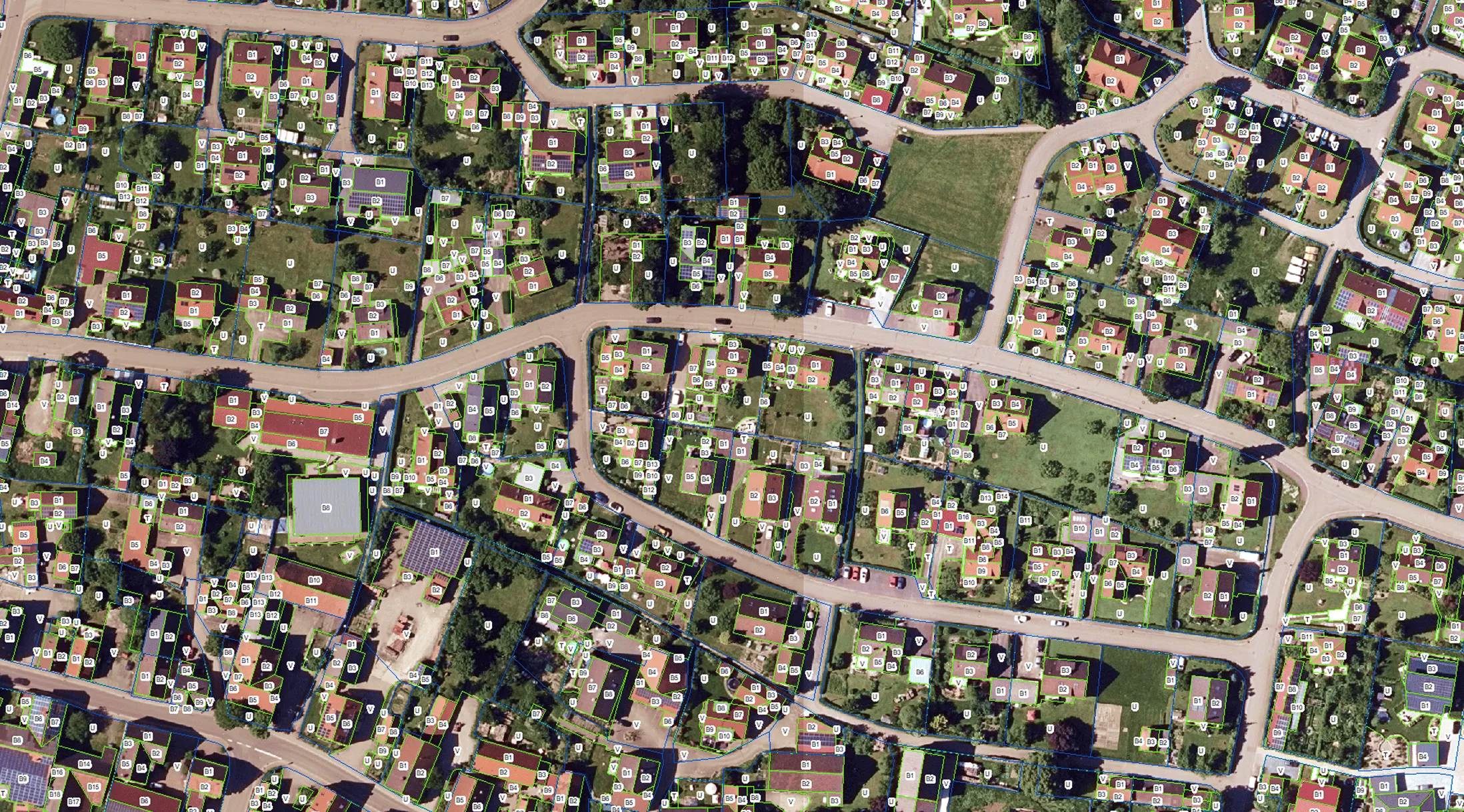


The project’s objective was to create a detailed digital map of all impervious and permeable surfaces within a defined area, covering roads, buildings, and other technical and vegetation-related features. The dataset was produced based on SHP files and orthophotos provided by the client, involving precise boundary matching and careful digitization of all visibly identifiable surface elements.
During production, Archizem applied consistent geometric rules for technical structures: buildings, parking areas, garages, terraces, and roads were digitized using orthogonal geometry and parallel lines. Impervious surfaces were segmented according to land parcel boundaries, while small and temporary objects (e.g., tents, pools, minor garden structures) were excluded from the mapping.
Particular attention was paid to geometric accuracy and correct surface sealing classification. Each change in material or surface type was clearly delineated, and small roof sections were mapped only where technically relevant.
As a result, the client received a high-detail impervious/permeable surface map, structured and ready for use in GIS. This dataset is suitable for stormwater infiltration and runoff assessment, infrastructure planning, and integration into spatial management workflows.
.webp)