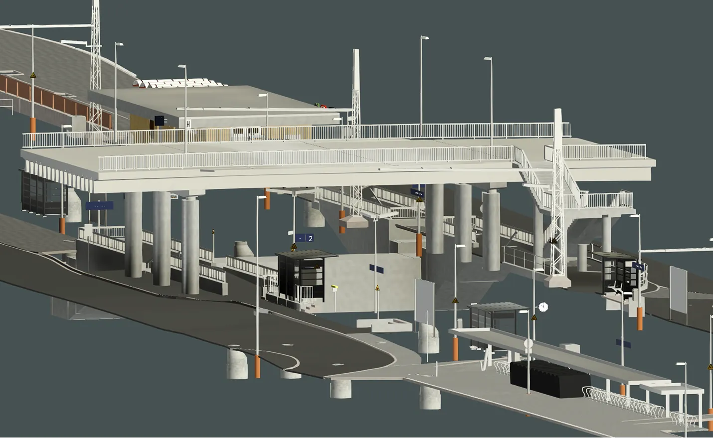


Archizem specialists developed a BIM model to facilitate the planning of noise barriers along an 8 km railway section. The model represents the existing infrastructure conditions, providing a solid foundation for subsequent design and engineering decisions.
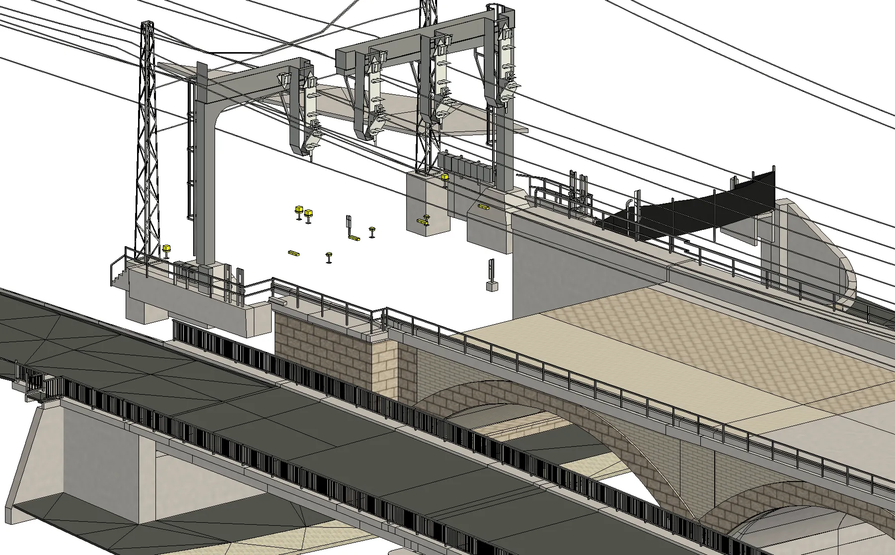
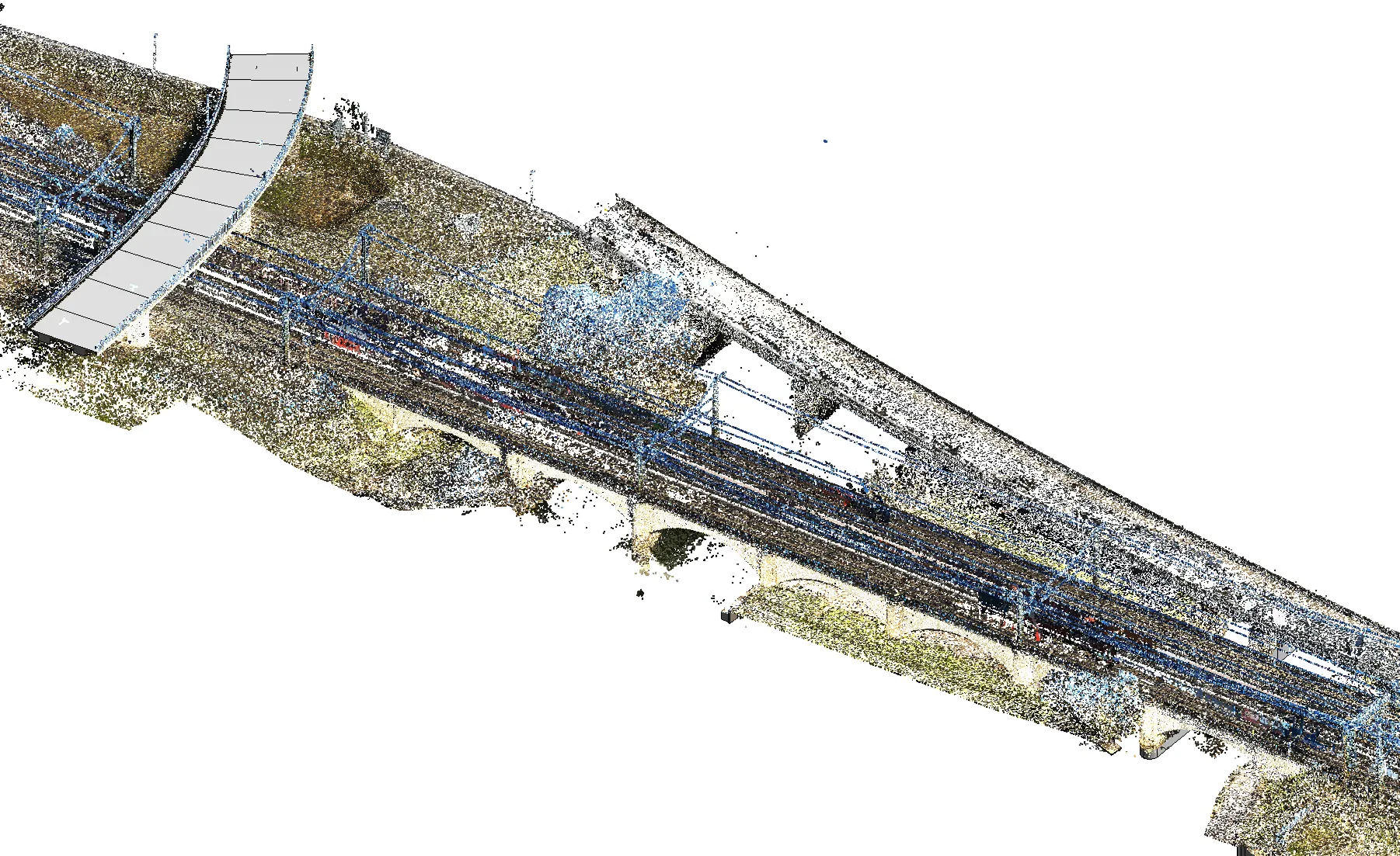
The work was based on high-precision laser scanning data. The resulting BIM model, created with an accuracy of 3–5 cm at LOD 100, was developed in parallel with a Digital Terrain Model (DTM) and a 3D plan. This integrated approach ensured full alignment and consistency between all spatial datasets.
Modeled assets included overhead contact lines with masts, handrails, existing noise barriers, walls, retaining walls, signals, turnouts, and bridges. The final deliverables—a BIM model in RVT and IFC formats—provide an essential tool for effective planning and engineering analysis.