Topographic Base Map at a Scale of 1:2,000 for Settlements in Odesa Oblast

2021
No items found.

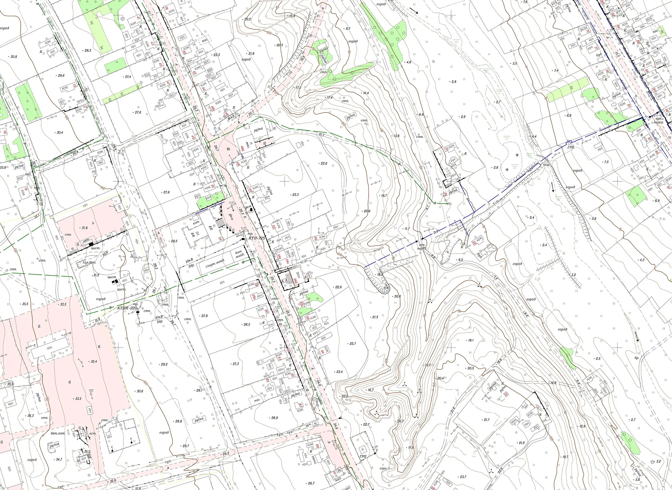
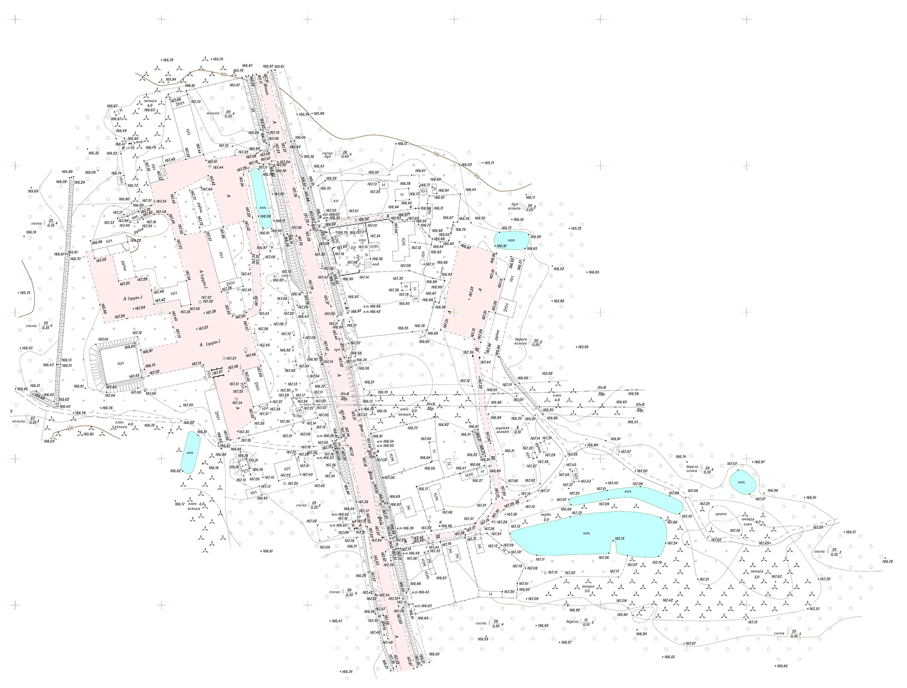
The Archizem team produced a digital topographic base map at a scale of 1:2,000 for the territories of several settlements in Odesa Oblast, as well as adjacent areas outside their boundaries, to support the development of urban planning documentation. The total project area was approximately 4,383 hectares.

To execute the required topographic and geodetic works, the team performed aerial surveying, established horizontal and vertical control networks, and conducted total station surveys using GNSS receivers and electronic total stations. This integrated approach ensured comprehensive and consistent source data for subsequent planning and design tasks.

The digital topographic base map was compiled in Delta/Digitals software and subsequently converted into an ArcGIS geodatabase.

Deliverables were provided in the following formats:

  • An ArcGIS File Geodatabase (.gdb) with geospatial vector datasets and map documents for 1:2,000 plan sheets (.mxd);
  • Vector topographic data in .dmf, .dwg, and .shp formats;
  • Plan sheets in .pdf and .jpg formats;
  • Additionally, the plan sheets were printed and delivered in hard-copy format.

Similar projects:

Stormwater Infiltration Cadastre (Impervious/Permeable Surface Map)

The project’s objective was to create a detailed digital map of all impervious and permeable surfaces within a defined area, covering roads, buildings, and other technical and vegetation-related features. The dataset was produced based on SHP files and orthophotos provided by the client, involving precise boundary matching and careful digitization of all visibly identifiable surface elements.
SEE DETAILS

Digital 1:10,000 Topographic Base for a Territorial Community (23,000 ha)

For a territorial community encompassing 23,000 ha, Archizem specialists produced a seamless digital topographic base at a scale of 1:10,000. The work was executed in accordance with all applicable geodetic and cartographic standards. Data collection involved topographic and geodetic surveying using electronic total stations and GNSS receivers across the entire area.
SEE DETAILS

Free data audit and calculation — within 24 hours.

Submit your request

Our specialists will conduct a free analysis of your source data and provide a detailed proposal with cost and timelines within one business day.
Grazie! Your submission has been received!
We have received your request and will contact you shortly
Oops! Something went wrong. Please try again.