Cross-Section Profiles of a Railway Track Based on Point Clouds

2025
No items found.

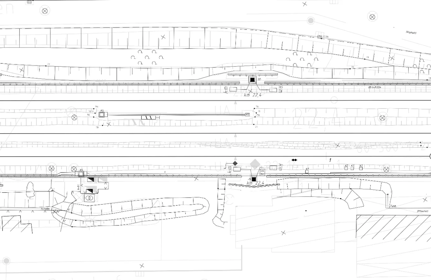
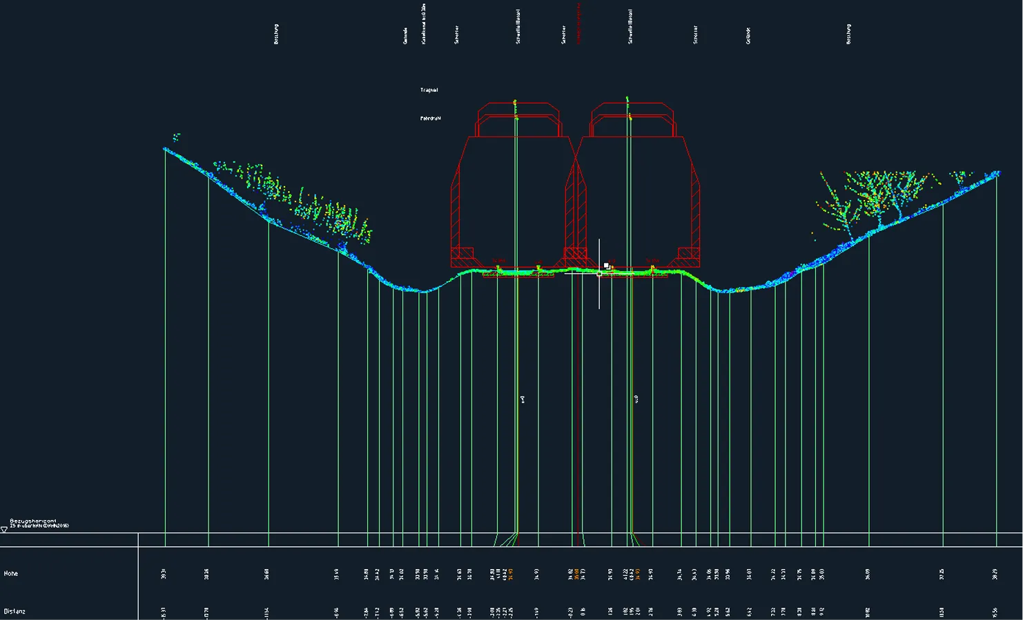
Archizem’s engineering team produced precise cross-section profiles for a railway track section using point cloud data. To achieve high accuracy, mobile laser scanning data from the Trimble MX9 system was integrated with total station survey results, creating a highly reliable and detailed source dataset.

The resulting profiles provide an essential tool for engineering analysis and verifying track geometry parameters. They enable compliance checks against regulatory requirements, facilitate earthwork volume estimation, and form a accurate basis for planning repair or reconstruction work.

These deliverables equip the client with a robust foundation for technical calculations and decision-making, enhancing the efficiency of railway infrastructure condition assessment and project planning.

Similar projects:

Topographic Plan (1:200) for Railway Infrastructure Reconstruction

Archizem completed the office processing of topographic and geodetic data and produced a detailed topographic plan at a scale of 1:200 for a railway corridor approximately 4.75 km long and up to 60 m wide. The plan captures all railway and engineering infrastructure elements, as well as adjacent areas, within the project scope.
SEE DETAILS

Topographic Site Plan (1:500) for Design Documentation Update

Archizem prepared a detailed topographic site plan at a scale of 1:500 for a 3.5-hectare electrical substation site to support the update of its design documentation. The plan meticulously maps all key engineering infrastructure elements and adjacent areas within the project boundaries.
SEE DETAILS

Free data audit and calculation — within 24 hours.

Submit your request

Our specialists will conduct a free analysis of your source data and provide a detailed proposal with cost and timelines within one business day.
Grazie! Your submission has been received!
We have received your request and will contact you shortly
Oops! Something went wrong. Please try again.