%201.webp)
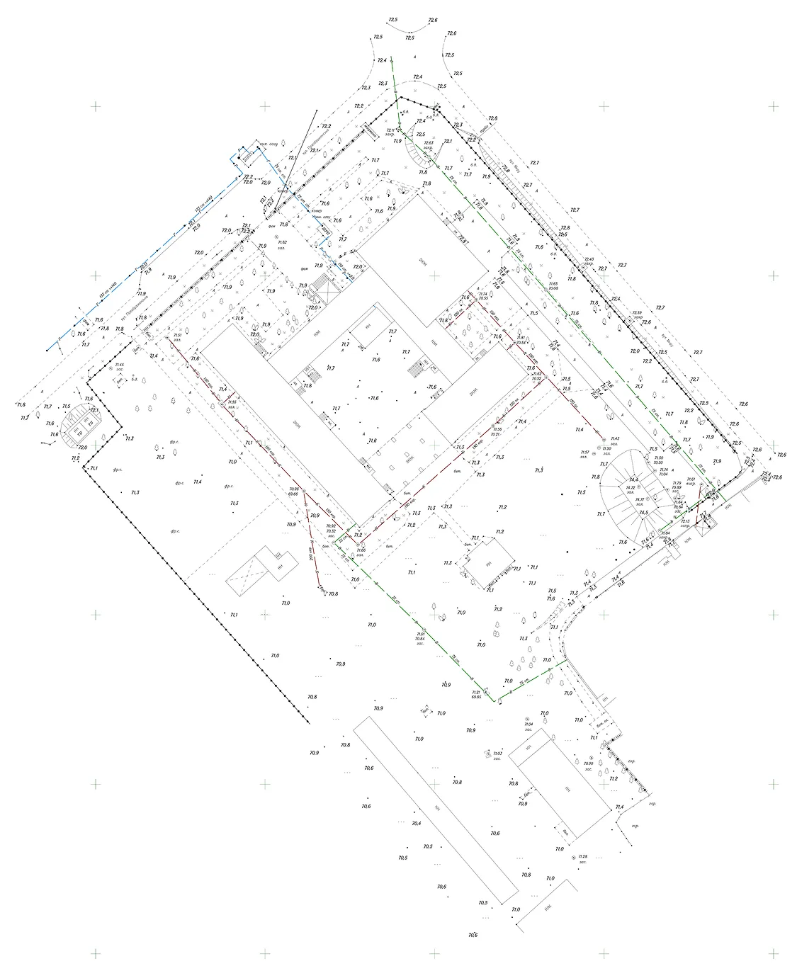
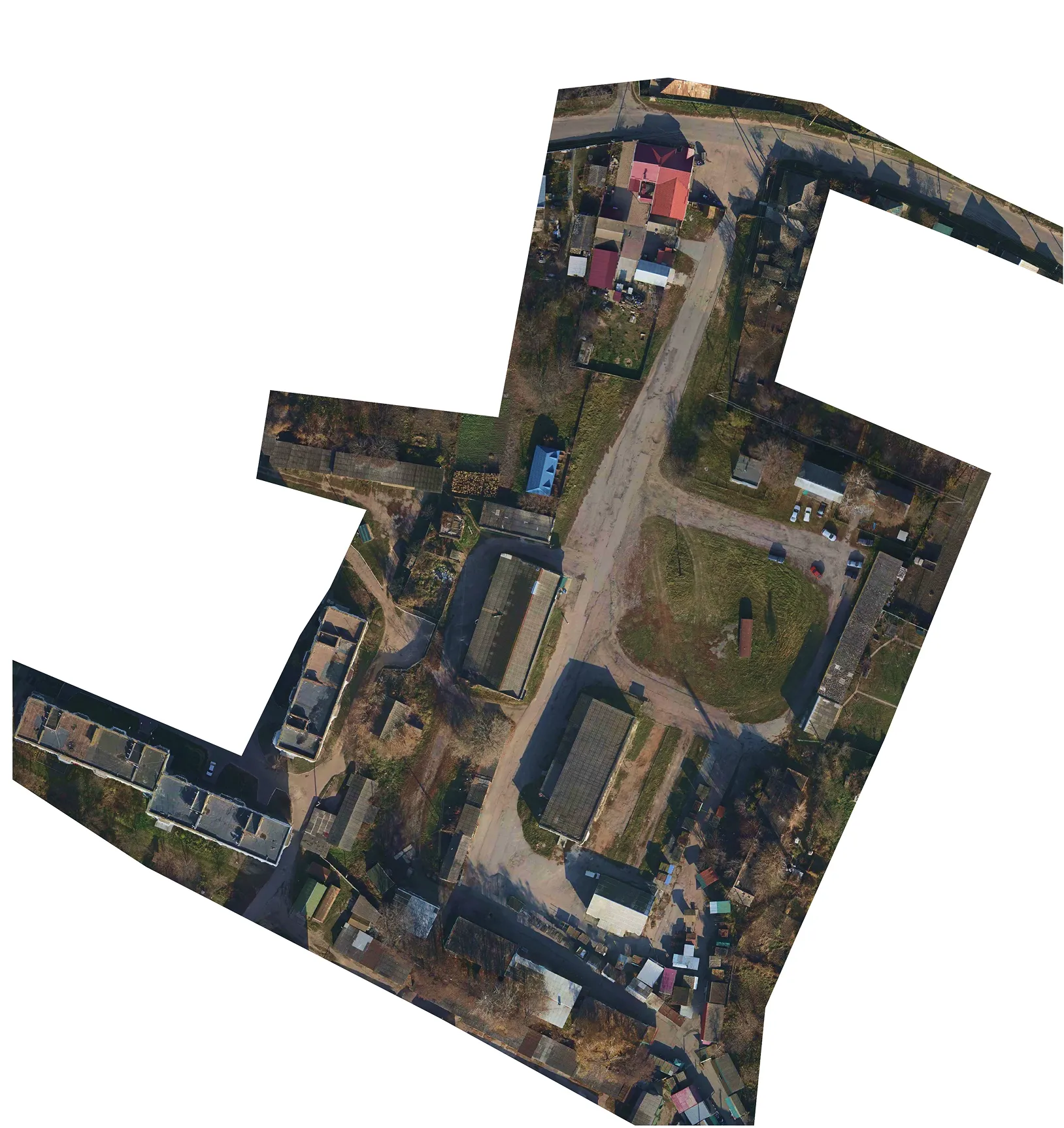
The Archizem team produced a digital topographic base at a scale of 1:500 for a land plot in Odesa Oblast to deliver accurate source data for engineering design documentation.
All works were completed in compliance with applicable geodetic and cartographic standards. The actual survey area covered 3.14 hectares.
Field activities included a tachymetric survey using electronic total stations and GNSS receivers, a preliminary assessment of available State Geodetic Network points within the project area, and the establishment of a dedicated horizontal and vertical control network.
Office processing and final drafting were performed in Delta/Digitals software, with subsequent conversion of results into ArcGIS formats. The resulting digital topographic base serves as a reliable and precise foundation for all subsequent design stages and ensures data consistency across different engineering disciplines.