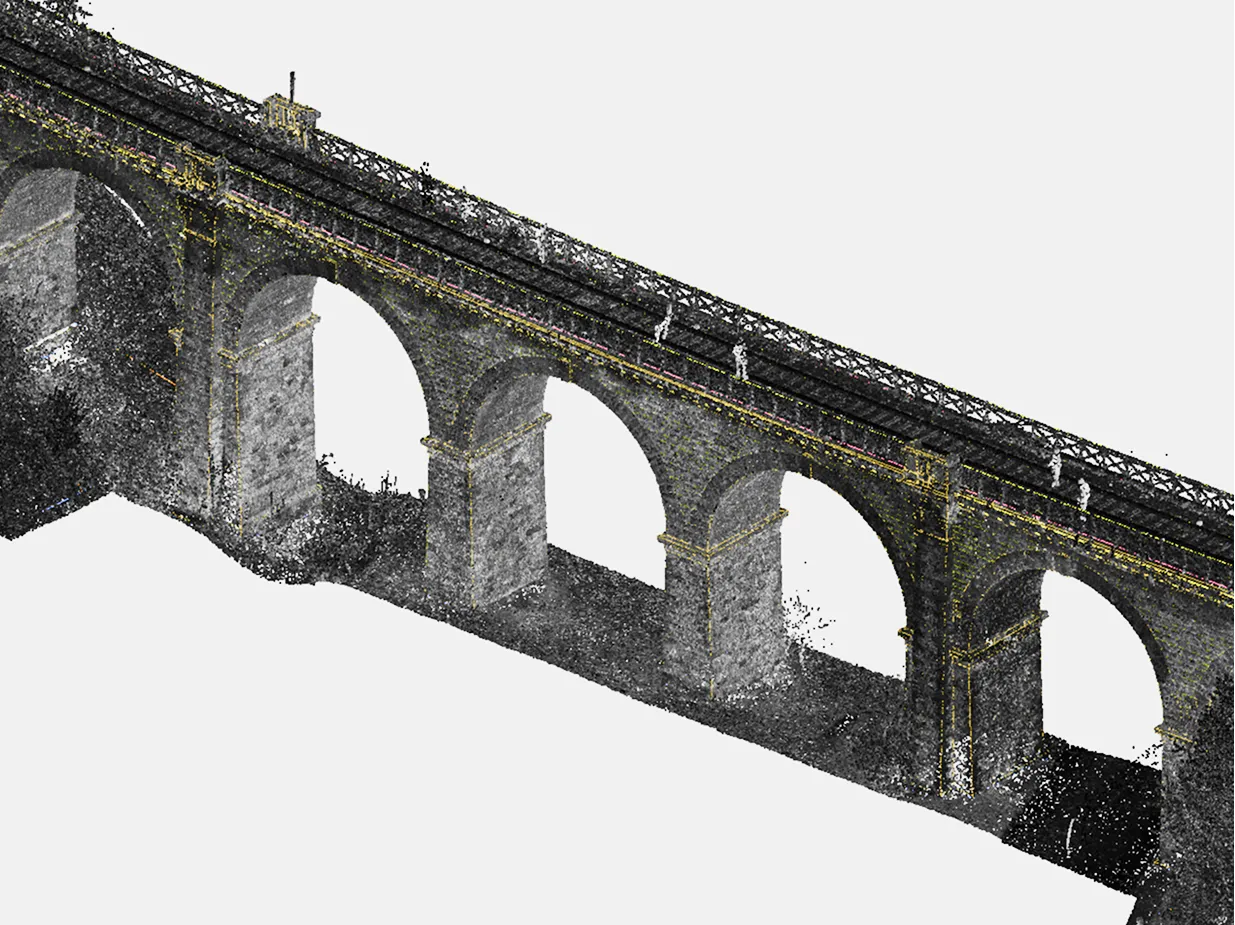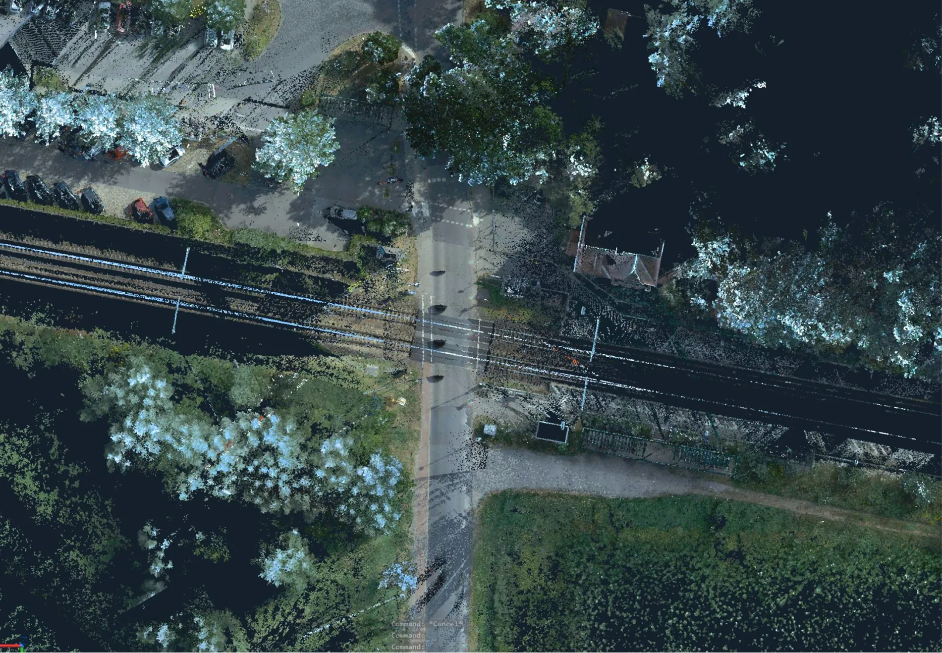
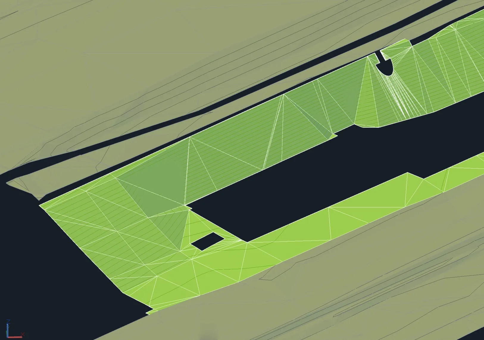
Archizem's engineering team developed a precise Digital Terrain Model (DTM) for a 450-meter railway corridor section, covering a 50-meter wide area that included both infrastructure and adjacent land.
The DTM was generated using static point clouds and total station survey data, achieving an accuracy of 5 cm relative to the point cloud. This ensured a reliable representation of site conditions for engineering calculations and planning.
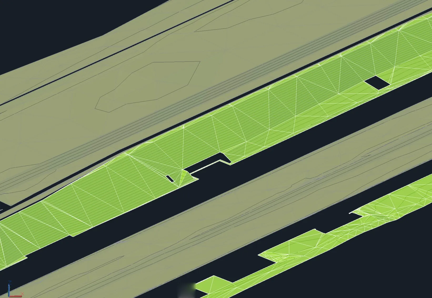
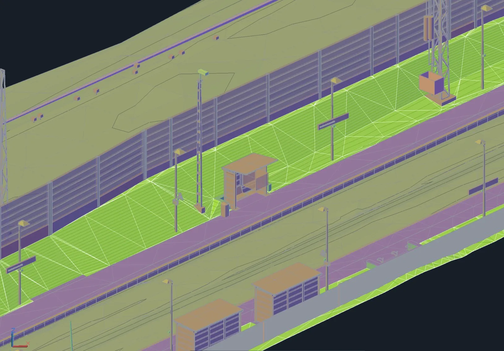
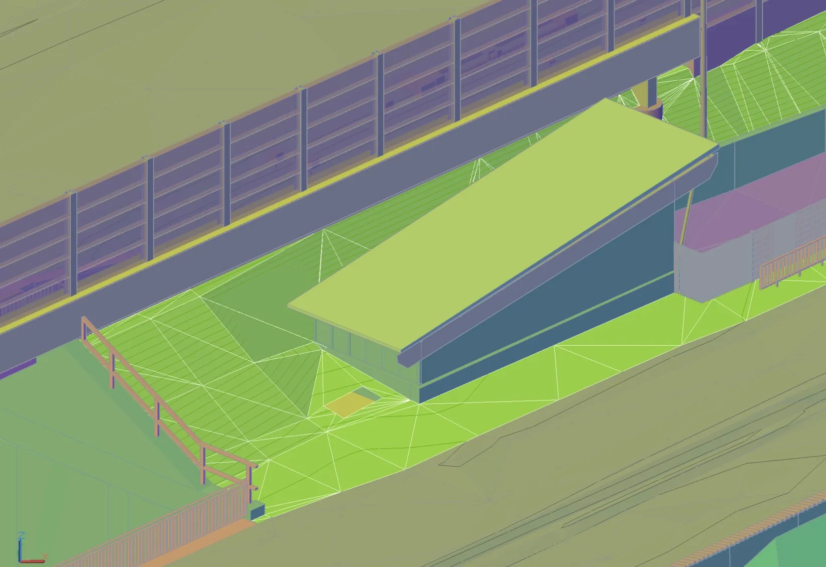
A critical project task was the parallel development of a BIM model for railway assets and the subsequent alignment of the DTM with this model. Man-made features were extracted and integrated to guarantee data interoperability. The terrain was also classified into separate surfaces, such as the track bed and vegetation zones.
This integrated dataset provides a robust foundation for railway reconstruction projects, enhancing planning efficiency and design accuracy.