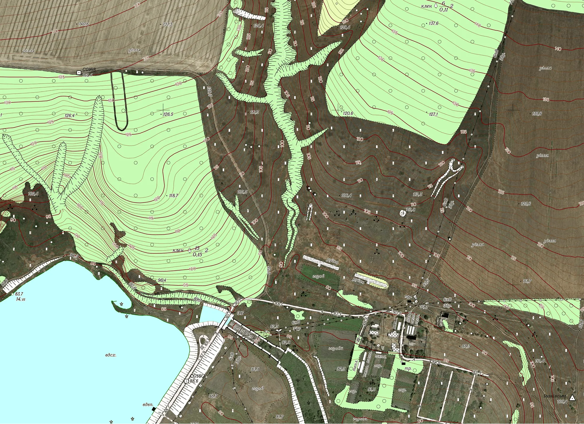
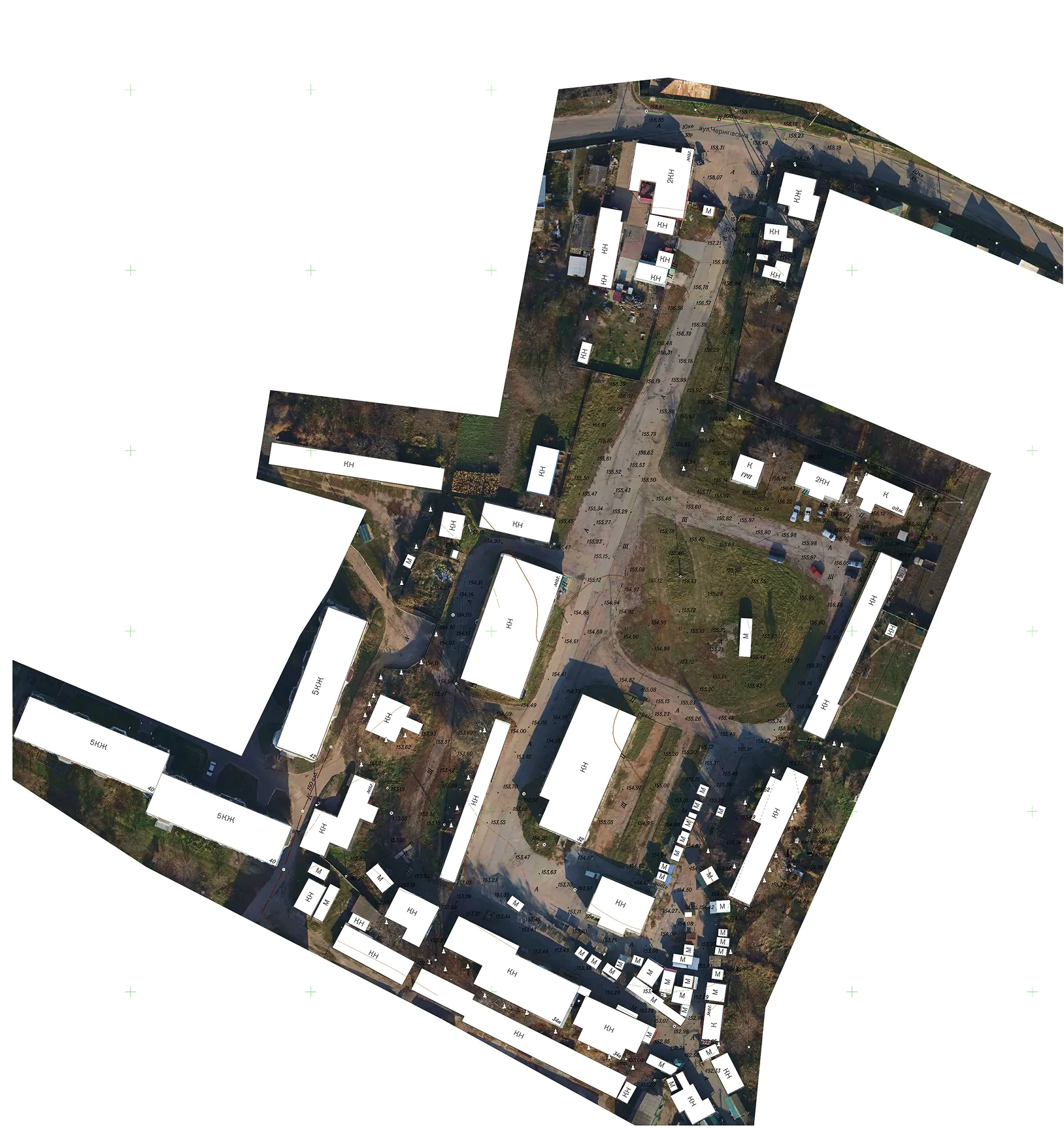

The Archizem team produced a digital topographic base at a scale of 1:500 for a land plot in Chernihiv Oblast. The work was carried out to provide reliable geospatial data for the preparation of design documentation for construction and related engineering purposes.
The topographic base was compiled as a single, consistent dataset in accordance with applicable geodetic and cartographic standards. The surveyed area totaled 2.7 hectares.
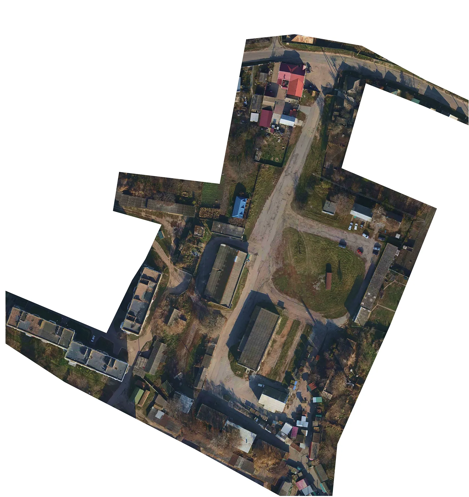
Field data acquisition was performed using total station surveying supported by GNSS receivers, supplemented by aerial imagery. The resulting digital topographic base includes comprehensive quantitative and qualitative attributes and feature codes in line with Ukraine's topographic information classifier for scales 1:5,000, 1:2,000, 1:1,000, and 1:500. The deliverable is a topologically correct geospatial dataset.
%201.webp)