Topographic Site Plan (1:500) for Design Documentation Update

2024
No items found.

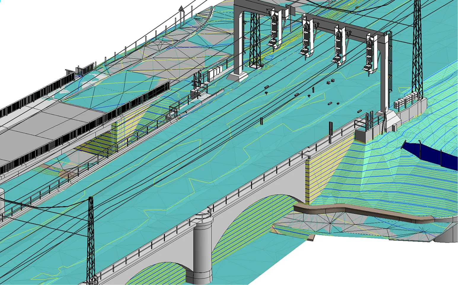
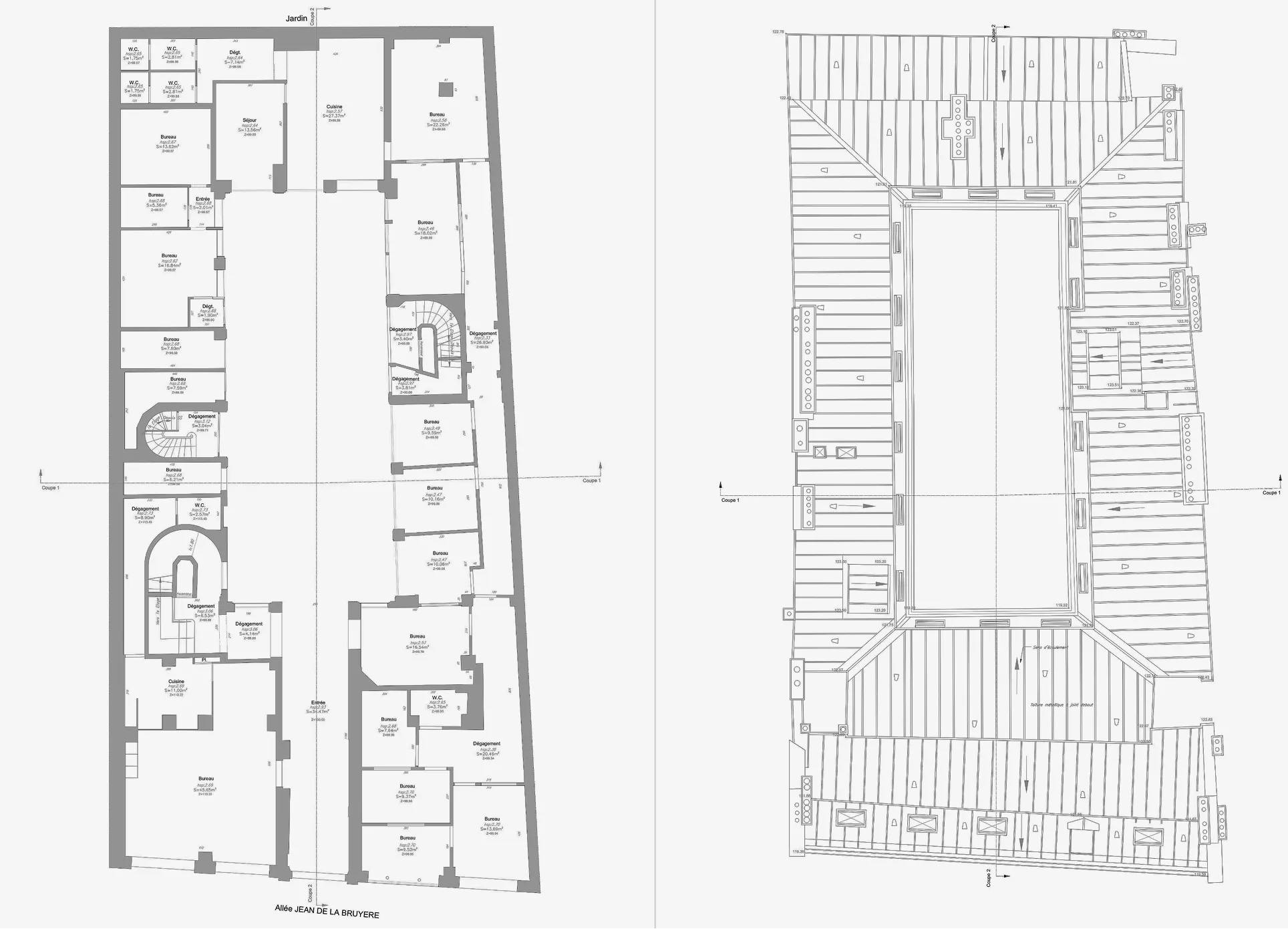
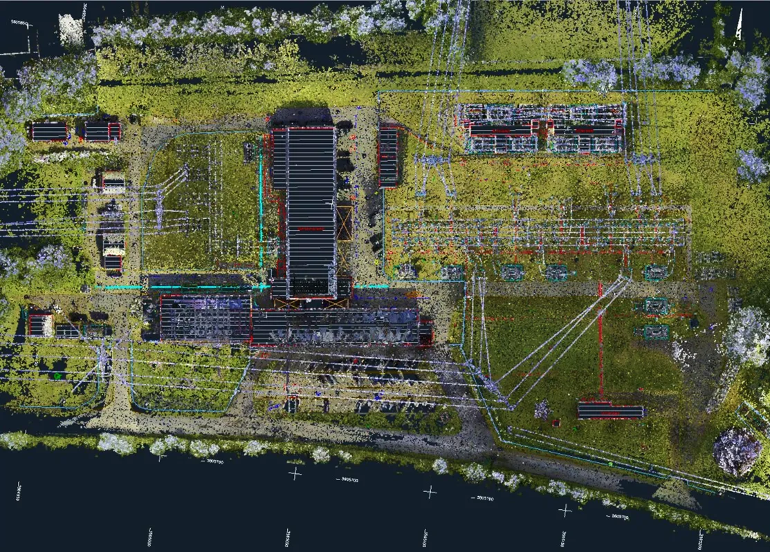
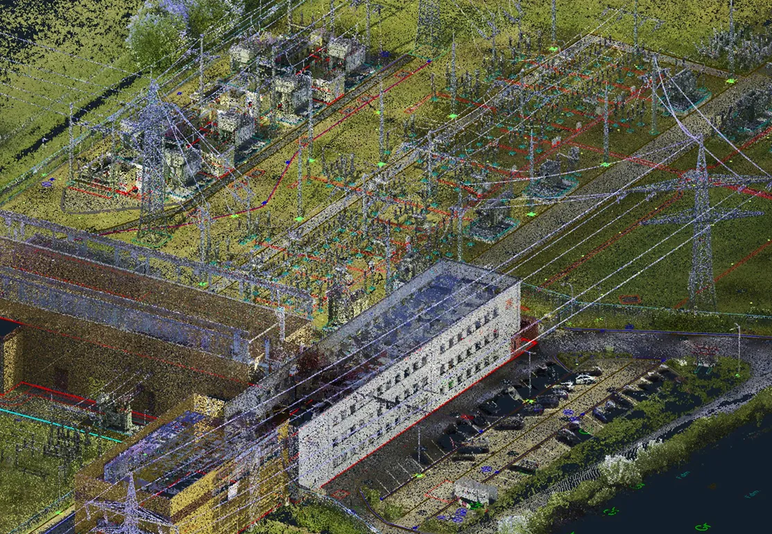
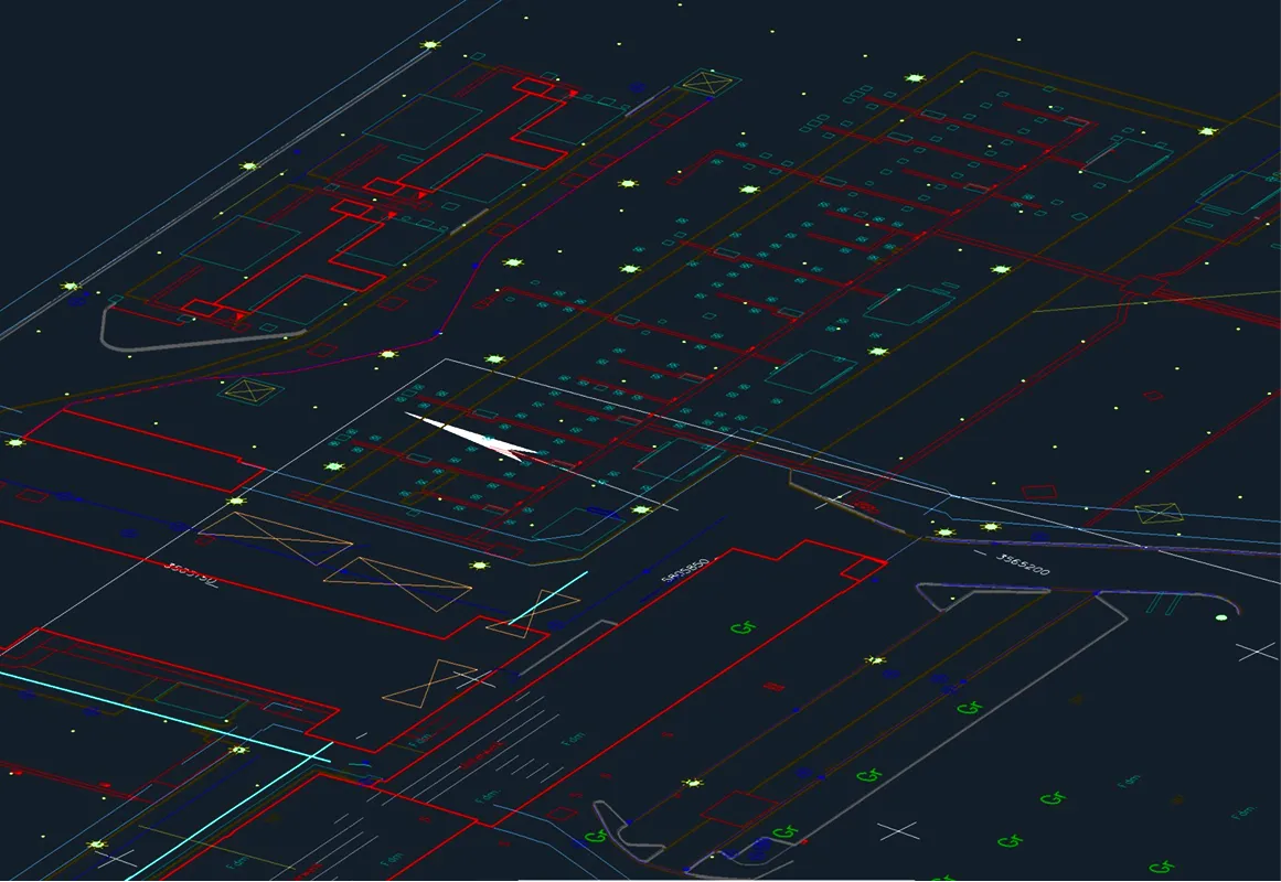
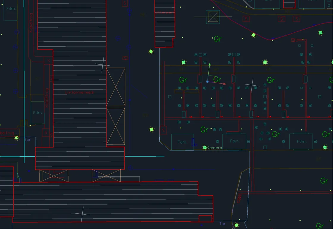
Archizem prepared a detailed topographic site plan at a scale of 1:500 for a 3.5-hectare electrical substation site to support the update of its design documentation. The plan meticulously maps all key engineering infrastructure elements and adjacent areas within the project boundaries.

The topographic base was compiled using current aerial survey data, delivering the accuracy and level of detail necessary for engineering design.

This updated topographic data provides a reliable geospatial foundation for developing working design documentation and informs critical engineering decisions.

Similar projects:

Cross-Section Profiles of a Railway Track Based on Point Clouds

Archizem’s engineering team produced precise cross-section profiles for a railway track section using point cloud data. To achieve high accuracy, mobile laser scanning data from the Trimble MX9 system was integrated with total station survey results, creating a highly reliable and detailed source dataset.
SEE DETAILS

Topographic Plan (1:200) for Railway Infrastructure Reconstruction

Archizem completed the office processing of topographic and geodetic data and produced a detailed topographic plan at a scale of 1:200 for a railway corridor approximately 4.75 km long and up to 60 m wide. The plan captures all railway and engineering infrastructure elements, as well as adjacent areas, within the project scope.
SEE DETAILS

Free data audit and calculation — within 24 hours.

Submit your request

Our specialists will conduct a free analysis of your source data and provide a detailed proposal with cost and timelines within one business day.
Grazie! Your submission has been received!
We have received your request and will contact you shortly
Oops! Something went wrong. Please try again.