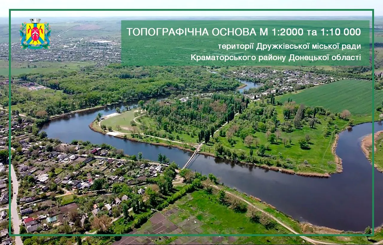

Employees of the company “Archizem” completed the implementation of a complex of works on the creation of a digital topographic basis of scale 1:2,000 and 1:10,000 of the territory of Druzhkivsk city territorial community of Donetsk region Druzhkivsk City Council
The urban territorial community includes 19 settlements, namely: the city of Druzhkivka, the villages of Alekseeve-Druzhkivka, Novohryhorivka, Novomykolaivka, Raiske, Kondrativka, Chervonyi Kut, Kurtivka, Mykolaivske, Novopavlivka, Osikove, Pavlivka, Petrovka, Shelter, Rayske, Sofiivka, Staroraiske, Toretske, Torske.
For the territories of settlements, the topographic basis is made on a scale of 1:2,000 for a total area of 2,775 hectares (27.75 sq. km). A topographic basis was also made on a scale of 1:10,000 for the entire territory of the community and for a total area of 29,050 hectares (290.50 sq. km).
The whole complex of works consisted of three stages:
Stage 1. Preparatory and field work.
Stage 2. Conversion of the existing topographic base M 1:2000 of Druzhkivka city from the vector format *.shp to the geodata database of the ArcGIS geo-information system.
Stage 3. Carrying out camera work, bringing the results into a single digital topographic basis.
During the preparatory work, our specialists collected and analyzed the initial data, including archival cartographic materials of the relevant territories of different years of production and different scales.
During the field work, topographic and geodetic surveys of the area were carried out, namely: survey of DGS (State Geodetic Network) points, aerial photography, plane-altitude survey of the territory, field deciphering of the terrain, tacheometric surveying.
Note that the materials of the digital topographic basis are developed in accordance with the current regulatory documents regulating the maintenance of the urban planning cadastre of the Donetsk region, in particular in accordance with the Order of the Department of Urban Planning and Architecture of the Donetsk Regional State Administration “On approval of technical documentation for the formation of a unified digital topographic base for the maintenance of the urban planning cadastre” from 22.04.2019 №16-ONE/133-19. In this regard, our company has converted the existing topographic basis of 1:2000 scale of Druzhkivka of vector format *.shp into the geodata base of ArcGIS geo-information system, for further inclusion in the urban planning cadastre of Donetsk region.
At the final stage, the cameral processing of all materials obtained as a result of field work was carried out, and in September the final work on the preparation of topographic plans was carried out. As a result, the obtained materials were compiled into a single array of digital data in the format of the ArcGIS geoinformation system, and then the finished tablets from the electronic format were printed on the nomenclature sheets.
On September 30, the following were transferred to the Executive Committee of Druzhkov City Council:
- topographic plans of territories of settlements on tablets of scale 1:2000 and territories outside settlements on tablets of scale 1:10 000,
- aerial photography materials,
- digital version of the topobase in the ArcGIS geodata database, as well as in the formats *.shp, *.dmf (Digitals) and *.dwg (AutoCAD) with reference to the coordinate system ISK-14.
The digital version of land plans can be used for the development of urban planning and land management documentation, for land inventory, in the development of a comprehensive plan of spatial development, the establishment and registration of boundaries of AHs and settlements in the Cadastre, and also allows you to use materials for the formation of extracts (Extract) of information, to make changes and additions to the geodata database.